
Half Island SG
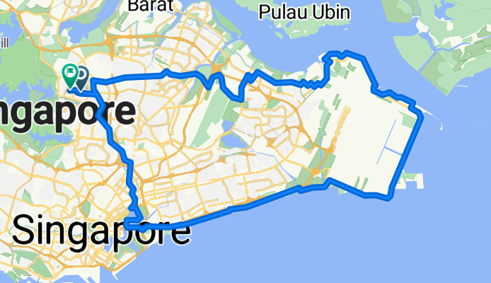
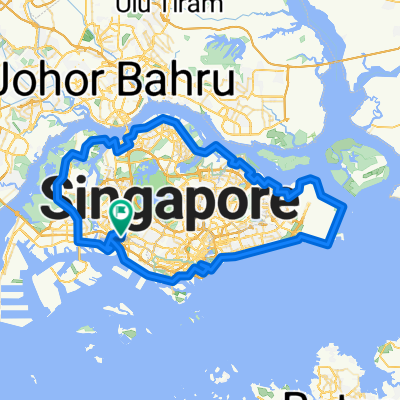
A cycling route starting in Singapore, Central Singapore Community Development Council, Singapore.
Overview
About this route
Explore the thrill of cycling along this scenic trail, perfect for adventure seekers. Starting at a charming village, the route unfolds with gentle climbs and exhilarating descents, offering a balanced challenge for riders of all levels. With an elevation gain of 478 meters and a descent of 483 meters, you'll feel the rush as you conquer the varied terrain. The trail's maximum elevation of 31 meters ensures a dynamic ride, with moments of both elevation and speed. The surface is a mix of smooth pavements and light gravel, providing a comfortable and engaging experience. Covering a distance of 70.9 kilometers, this route promises an unforgettable journey through picturesque landscapes and vibrant rural settings. Whether you're a seasoned cyclist or new to the sport, this adventure is sure to invigorate your senses and reward your efforts with stunning views and a sense of accomplishment.
AI generated
- 5 h 13 min
- Duration
- 70.9 km
- Distance
- 479 m
- Ascent
- 484 m
- Descent
- 13.6 km/h
- Avg. speed
- 31 m
- Max. altitude

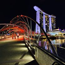
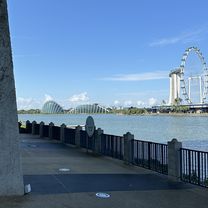
Route photos

Continue with Bikemap
Use, edit, or download this cycling route
You would like to ride Half Island SG or customize it for your own trip? Here is what you can do with this Bikemap route:
Free features
- Save this route as favorite or in collections
- Copy & plan your own version of this route
- Sync your route with Garmin or Wahoo
Premium features
Free trial for 3 days, or one-time payment. More about Bikemap Premium.
- Navigate this route on iOS & Android
- Export a GPX / KML file of this route
- Create your custom printout (try it for free)
- Download this route for offline navigation
Discover more Premium features.
Get Bikemap PremiumFrom our community
Other popular routes starting in Singapore
 170328 lorong halus
- Distance
- 6 km
- Ascent
- 20 m
- Descent
- 21 m
- Location
- Singapore, Central Singapore Community Development Council, Singapore
 Singapore PCN Cycle Loop
- Distance
- 143.4 km
- Ascent
- 556 m
- Descent
- 538 m
- Location
- Singapore, Central Singapore Community Development Council, Singapore
 Half Island SG
- Distance
- 70.9 km
- Ascent
- 479 m
- Descent
- 484 m
- Location
- Singapore, Central Singapore Community Development Council, Singapore
 Punggol Rd, Singapore to Helix Bridge, Singapore
- Distance
- 17.8 km
- Ascent
- 245 m
- Descent
- 251 m
- Location
- Singapore, Central Singapore Community Development Council, Singapore
 80km - Round (Middle) Island
- Distance
- 78.6 km
- Ascent
- 189 m
- Descent
- 189 m
- Location
- Singapore, Central Singapore Community Development Council, Singapore
 Punggol East, Singapore to Kallang, Singapore
- Distance
- 49.6 km
- Ascent
- 125 m
- Descent
- 130 m
- Location
- Singapore, Central Singapore Community Development Council, Singapore
 Sengkang to Stadium via PLQ Mall
- Distance
- 14.1 km
- Ascent
- 73 m
- Descent
- 78 m
- Location
- Singapore, Central Singapore Community Development Council, Singapore
 Tampines Hub to Changi Village
- Distance
- 10.2 km
- Ascent
- 87 m
- Descent
- 108 m
- Location
- Singapore, Central Singapore Community Development Council, Singapore
Open it in the app