Balkanroute-Troisdorf
A cycling route starting in Deutz, North Rhine-Westphalia, Germany.
Overview
About this route
Alles hinter Sieglar ist für die Troisdorfer der Balkan und so hat man die einst viel gepriesene Fahrrad-Magistrale entlang der Bahnstrecke von Sieglar nach Mondorf "Balkanroute" genannt. So toll, wie die Väter des Farradfreundlichen Troisdorf das wohl einmal dachten, ist der Weg mit seinem teilweise recht buckligen Beton-Verbundstein-Pflaster nun auch nicht, er ist aber die einzige autofreie Alternative, wenn man von Eschmar nach Mondorf möchte. Und den meisten Troisdorfern dürfte das Teilstück von Berheim nach Mondorf unbekannt sein.
- -:--
- Duration
- 61.4 km
- Distance
- 55 m
- Ascent
- 52 m
- Descent
- ---
- Avg. speed
- ---
- Avg. speed
Route quality
Waytypes & surfaces along the route
Waytypes
Path
29.1 km
(47 %)
Quiet road
17.8 km
(29 %)
Surfaces
Paved
57.8 km
(94 %)
Unpaved
0.9 km
(2 %)
Asphalt
49.8 km
(81 %)
Paving stones
5.3 km
(9 %)
Route highlights
Points of interest along the route
Point of interest after 25.8 km
Balkanroute begin in Sieglar
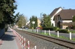
Photo after 26.6 km
Balkanroute
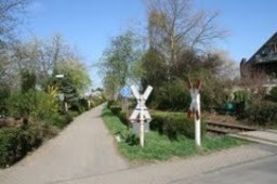
Photo after 27.6 km
Balkanroute in Eschmar

Point of interest after 29.1 km
Hong Yun China-Restaurant Elly-Heuss-Knapp-Platz 3 Krausacker - Bergheim 53844 Troisdorf 0228 9456825
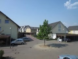
Photo after 29.7 km
Balkanroute in Bergheim
Point of interest after 31.1 km
Balkanroute Ende

Photo after 38.1 km
Eschmarer Str in Uckendorf
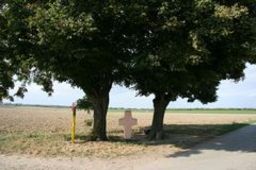
Photo after 42.9 km
zur Andacht

Photo after 45.2 km
Deich
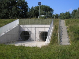
Photo after 48.7 km
Köln-Langel, Flutungsbauwerk im Rheindamm

Photo after 51.6 km
Rheinweg
Continue with Bikemap
Use, edit, or download this cycling route
You would like to ride Balkanroute-Troisdorf or customize it for your own trip? Here is what you can do with this Bikemap route:
Free features
- Save this route as favorite or in collections
- Copy & plan your own version of this route
- Sync your route with Garmin or Wahoo
Premium features
Free trial for 3 days, or one-time payment. More about Bikemap Premium.
- Navigate this route on iOS & Android
- Export a GPX / KML file of this route
- Create your custom printout (try it for free)
- Download this route for offline navigation
Discover more Premium features.
Get Bikemap PremiumFrom our community
Other popular routes starting in Deutz
 Kölner Östlicher Regionen
- Distance
- 37.3 km
- Ascent
- 88 m
- Descent
- 81 m
- Location
- Deutz, North Rhine-Westphalia, Germany
 Gammersbacher-Mühle
- Distance
- 66.8 km
- Ascent
- 242 m
- Descent
- 250 m
- Location
- Deutz, North Rhine-Westphalia, Germany
 Altenberger Dom
- Distance
- 57.9 km
- Ascent
- 138 m
- Descent
- 143 m
- Location
- Deutz, North Rhine-Westphalia, Germany
 Köln - Wermelskirchen - Radevormwald - Schwelm
- Distance
- 61.3 km
- Ascent
- 484 m
- Descent
- 207 m
- Location
- Deutz, North Rhine-Westphalia, Germany
 Wahnheide
- Distance
- 59.3 km
- Ascent
- 173 m
- Descent
- 162 m
- Location
- Deutz, North Rhine-Westphalia, Germany
 Rheintour
- Distance
- 31.3 km
- Ascent
- 74 m
- Descent
- 76 m
- Location
- Deutz, North Rhine-Westphalia, Germany
 Köln
Köln- Distance
- 5.2 km
- Ascent
- 19 m
- Descent
- 15 m
- Location
- Deutz, North Rhine-Westphalia, Germany
 Kölner_Nordöstlicher_Regionen
- Distance
- 38.7 km
- Ascent
- 94 m
- Descent
- 100 m
- Location
- Deutz, North Rhine-Westphalia, Germany
Open it in the app


