

Kleine Schönbuch-Runde mit Alb-Blick
A cycling route starting in Altenriet, Baden-Württemberg, Germany.
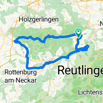
Overview
About this route
Bietet anfangs zwischen Walddorf, Häslach und Schlaitdorf schöne Blicke auf den Albtrauf. Danach geht's in den Schönbuch. Ein bisschen durch das Schaichtal, ein paar kleine Anstiege und Abfahrten :-). Und dann geht's auch schon wieder zurück nach Walddorf - wieder mit schönem Blick auf die Alb.
- -:--
- Duration
- 33.9 km
- Distance
- 508 m
- Ascent
- 475 m
- Descent
- ---
- Avg. speed
- 510 m
- Max. altitude
Route quality
Waytypes & surfaces along the route
Waytypes
Track
26.9 km
(79 %)
Quiet road
2.7 km
(8 %)
Surfaces
Paved
8.2 km
(24 %)
Unpaved
23.5 km
(69 %)
Gravel
14.1 km
(42 %)
Asphalt
7.9 km
(23 %)
Route highlights
Points of interest along the route
Point of interest after 20.9 km
Funkturm
Continue with Bikemap
Use, edit, or download this cycling route
You would like to ride Kleine Schönbuch-Runde mit Alb-Blick or customize it for your own trip? Here is what you can do with this Bikemap route:
Free features
- Save this route as favorite or in collections
- Copy & plan your own version of this route
- Sync your route with Garmin or Wahoo
Premium features
Free trial for 3 days, or one-time payment. More about Bikemap Premium.
- Navigate this route on iOS & Android
- Export a GPX / KML file of this route
- Create your custom printout (try it for free)
- Download this route for offline navigation
Discover more Premium features.
Get Bikemap PremiumFrom our community
Other popular routes starting in Altenriet
 Sommertour durch den Schönbuch
- Distance
- 54.4 km
- Ascent
- 289 m
- Descent
- 397 m
- Location
- Altenriet, Baden-Württemberg, Germany
 Kleine Schönbuch-Runde mit Alb-Blick
- Distance
- 33.9 km
- Ascent
- 508 m
- Descent
- 475 m
- Location
- Altenriet, Baden-Württemberg, Germany
 Walddorf - Bebenhausen - Mittelstadt
- Distance
- 44.8 km
- Ascent
- 303 m
- Descent
- 305 m
- Location
- Altenriet, Baden-Württemberg, Germany
 Walddorf - Plattenhardt (samtec) Variante 1
- Distance
- 13.2 km
- Ascent
- 234 m
- Descent
- 217 m
- Location
- Altenriet, Baden-Württemberg, Germany
 Walddorf - Mössingen retour
- Distance
- 67.4 km
- Ascent
- 632 m
- Descent
- 627 m
- Location
- Altenriet, Baden-Württemberg, Germany
 Aichtal-Dettenhausen-Runde
- Distance
- 36.8 km
- Ascent
- 507 m
- Descent
- 507 m
- Location
- Altenriet, Baden-Württemberg, Germany
 Rundreise Walddorfhäslach - Gruorn
- Distance
- 88.7 km
- Ascent
- 751 m
- Descent
- 751 m
- Location
- Altenriet, Baden-Württemberg, Germany
 Walddorf - Schönbuch - Wurmlingen - Rundtour
- Distance
- 72 km
- Ascent
- 477 m
- Descent
- 554 m
- Location
- Altenriet, Baden-Württemberg, Germany
Open it in the app