

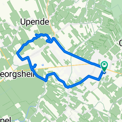
Lindenpfad nach Engerhafe
A cycling route starting in Aurich, Lower Saxony, Germany.
Overview
About this route
- 1 h 31 min
- Duration
- 16 km
- Distance
- 154 m
- Ascent
- 200 m
- Descent
- 10.5 km/h
- Avg. speed
- 47 m
- Max. altitude

Route quality
Waytypes & surfaces along the route
Waytypes
Path
8 km
(50 %)
Quiet road
6.6 km
(41 %)
Surfaces
Paved
4.6 km
(29 %)
Asphalt
4.6 km
(29 %)
Undefined
11.4 km
(71 %)
Continue with Bikemap
Use, edit, or download this cycling route
You would like to ride Lindenpfad nach Engerhafe or customize it for your own trip? Here is what you can do with this Bikemap route:
Free features
- Save this route as favorite or in collections
- Copy & plan your own version of this route
- Sync your route with Garmin or Wahoo
Premium features
Free trial for 3 days, or one-time payment. More about Bikemap Premium.
- Navigate this route on iOS & Android
- Export a GPX / KML file of this route
- Create your custom printout (try it for free)
- Download this route for offline navigation
Discover more Premium features.
Get Bikemap PremiumFrom our community
Other popular routes starting in Aurich
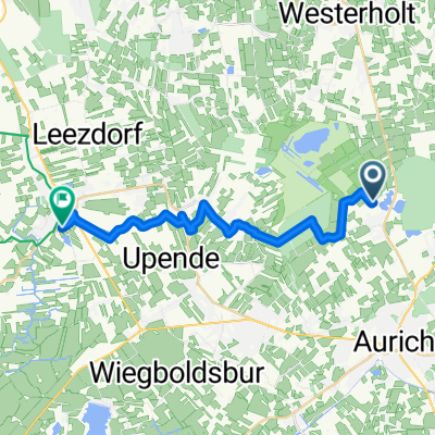
 Sonntagsrunde
- Distance
- 46.5 km
- Ascent
- 142 m
- Descent
- 140 m
- Location
- Aurich, Lower Saxony, Germany
 Picknicken am Kukelorum
- Distance
- 4.5 km
- Ascent
- 0 m
- Descent
- 6 m
- Location
- Aurich, Lower Saxony, Germany
 Lindenpfad nach Engerhafe
- Distance
- 16 km
- Ascent
- 154 m
- Descent
- 200 m
- Location
- Aurich, Lower Saxony, Germany
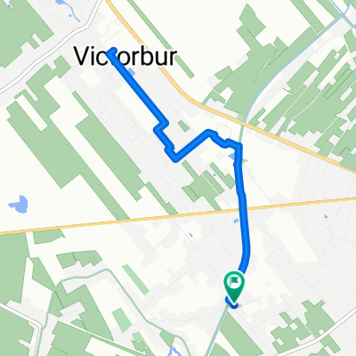 Spielplatz Victorbur
- Distance
- 6 km
- Ascent
- 0 m
- Descent
- 0 m
- Location
- Aurich, Lower Saxony, Germany
 Dornumer Straße 9, Aurich nach Dornumer Straße 7A, Aurich
- Distance
- 29.7 km
- Ascent
- 6 m
- Descent
- 16 m
- Location
- Aurich, Lower Saxony, Germany
 zur Tagespflege
- Distance
- 10.9 km
- Ascent
- 4 m
- Descent
- 10 m
- Location
- Aurich, Lower Saxony, Germany
 2) Badesee Tannenhausen bis Upgant-Schott
- Distance
- 22.6 km
- Ascent
- 14 m
- Descent
- 21 m
- Location
- Aurich, Lower Saxony, Germany
 Korbweidenstraße 40, Aurich nach Korbweidenstraße 40, Aurich
- Distance
- 21.7 km
- Ascent
- 43 m
- Descent
- 41 m
- Location
- Aurich, Lower Saxony, Germany
Open it in the app