
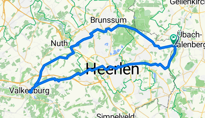
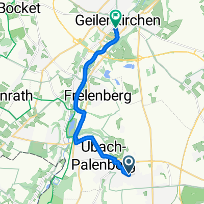
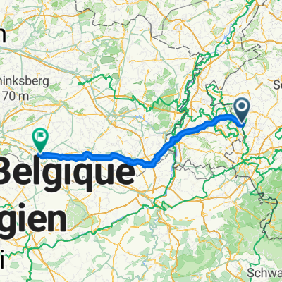
Route in Landgraaf
A cycling route starting in Übach-Palenberg, North Rhine-Westphalia, Germany.
Overview
About this route
- 3 h 5 min
- Duration
- 51.2 km
- Distance
- 342 m
- Ascent
- 343 m
- Descent
- 16.6 km/h
- Avg. speed
- 150 m
- Max. altitude

Route quality
Waytypes & surfaces along the route
Waytypes
Cycleway
22.5 km
(44 %)
Quiet road
19.4 km
(38 %)
Surfaces
Paved
24 km
(47 %)
Unpaved
1.5 km
(3 %)
Asphalt
21 km
(41 %)
Concrete
2.6 km
(5 %)
Continue with Bikemap
Use, edit, or download this cycling route
You would like to ride Route in Landgraaf or customize it for your own trip? Here is what you can do with this Bikemap route:
Free features
- Save this route as favorite or in collections
- Copy & plan your own version of this route
- Sync your route with Garmin or Wahoo
Premium features
Free trial for 3 days, or one-time payment. More about Bikemap Premium.
- Navigate this route on iOS & Android
- Export a GPX / KML file of this route
- Create your custom printout (try it for free)
- Download this route for offline navigation
Discover more Premium features.
Get Bikemap PremiumFrom our community
Other popular routes starting in Übach-Palenberg
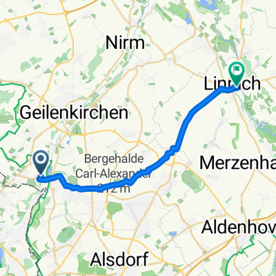 In der Gehölde, Übach-Palenberg nach Schwarzer Weg, Linnich
- Distance
- 17.8 km
- Ascent
- 78 m
- Descent
- 129 m
- Location
- Übach-Palenberg, North Rhine-Westphalia, Germany
 Übach-Palenberg nach Auf der Höhe, Übach-Palenberg
- Distance
- 0.9 km
- Ascent
- 0 m
- Descent
- 0 m
- Location
- Übach-Palenberg, North Rhine-Westphalia, Germany
 Ostern-Hendrik-2023-Maastricht_A
- Distance
- 44.6 km
- Ascent
- 354 m
- Descent
- 386 m
- Location
- Übach-Palenberg, North Rhine-Westphalia, Germany
 Route nach Apweilerstraße, Geilenkirchen
- Distance
- 9 km
- Ascent
- 51 m
- Descent
- 60 m
- Location
- Übach-Palenberg, North Rhine-Westphalia, Germany
 Gangelt Freiband und zurück !
- Distance
- 11.8 km
- Ascent
- 36 m
- Descent
- 85 m
- Location
- Übach-Palenberg, North Rhine-Westphalia, Germany
 In der Gehölde, Übach-Palenberg nach Schwarzer Weg, Linnich
- Distance
- 16.5 km
- Ascent
- 50 m
- Descent
- 98 m
- Location
- Übach-Palenberg, North Rhine-Westphalia, Germany
 Thornstraße, Übach-Palenberg nach Herzog-Wilhelm-Straße, Geilenkirchen
- Distance
- 7.9 km
- Ascent
- 11 m
- Descent
- 62 m
- Location
- Übach-Palenberg, North Rhine-Westphalia, Germany
 07 Landgraaf - Tienen (102 km)
- Distance
- 102.9 km
- Ascent
- 543 m
- Descent
- 628 m
- Location
- Übach-Palenberg, North Rhine-Westphalia, Germany
Open it in the app