
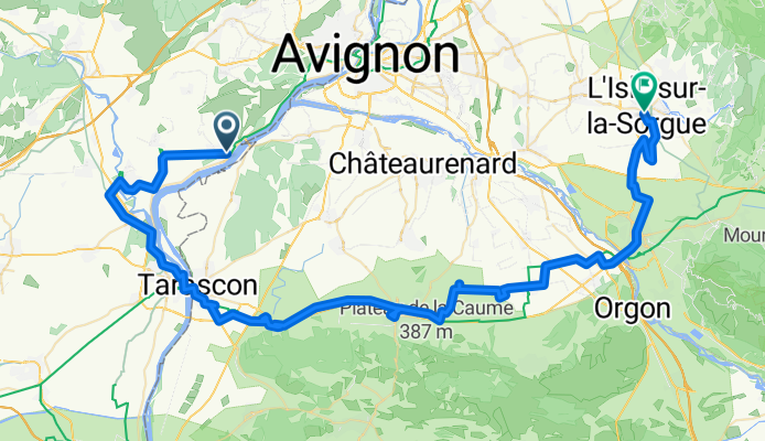
3 - Aramon - L'Isle sur la Sorgue
A cycling route starting in Aramon, Occitanie, France.
Overview
About this route
- 5 h 25 min
- Duration
- 87.7 km
- Distance
- 294 m
- Ascent
- 251 m
- Descent
- 16.2 km/h
- Avg. speed
- 77 m
- Max. altitude

Continue with Bikemap
Use, edit, or download this cycling route
You would like to ride 3 - Aramon - L'Isle sur la Sorgue or customize it for your own trip? Here is what you can do with this Bikemap route:
Free features
- Save this route as favorite or in collections
- Copy & plan your own version of this route
- Split it into stages to create a multi-day tour
- Sync your route with Garmin or Wahoo
Premium features
Free trial for 3 days, or one-time payment. More about Bikemap Premium.
- Navigate this route on iOS & Android
- Export a GPX / KML file of this route
- Create your custom printout (try it for free)
- Download this route for offline navigation
Discover more Premium features.
Get Bikemap PremiumFrom our community
Other popular routes starting in Aramon
 From Aramon to Saint-Hilaire-d'Ozilhan
- Distance
- 16.6 km
- Ascent
- 133 m
- Descent
- 96 m
- Location
- Aramon, Occitanie, France
 Avenue Général de Gaulle nach Chemin de Bellegarde
- Distance
- 15.5 km
- Ascent
- 114 m
- Descent
- 160 m
- Location
- Aramon, Occitanie, France
 Cours Victor Hugo 3, Aramon nach Chemin de Valive, Vers-Pont-du-Gard
- Distance
- 30.1 km
- Ascent
- 84 m
- Descent
- 45 m
- Location
- Aramon, Occitanie, France
 Aramon test
- Distance
- 8.6 km
- Ascent
- 6 m
- Descent
- 6 m
- Location
- Aramon, Occitanie, France
 3 - Aramon - L'Isle sur la Sorgue
- Distance
- 87.7 km
- Ascent
- 294 m
- Descent
- 251 m
- Location
- Aramon, Occitanie, France
 Aramon to Arles
- Distance
- 36.3 km
- Ascent
- 51 m
- Descent
- 47 m
- Location
- Aramon, Occitanie, France
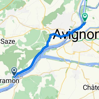
 Avignon long first.gpx - Avignon long first
- Distance
- 40.9 km
- Ascent
- 156 m
- Descent
- 154 m
- Location
- Aramon, Occitanie, France
 De Route de Montfrin 3544, Aramon à Chemin de la Garrigue 601B, Oppède
- Distance
- 74.6 km
- Ascent
- 117 m
- Descent
- 61 m
- Location
- Aramon, Occitanie, France
Open it in the app