

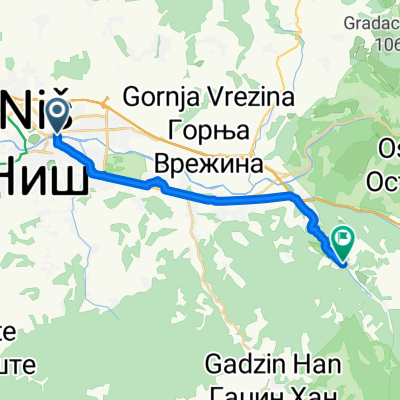
9. serbien tag 7
A cycling route starting in Niš, Central Serbia, Serbia.
Overview
About this route
- 10 h 44 min
- Duration
- 119.5 km
- Distance
- 1,984 m
- Ascent
- 1,801 m
- Descent
- 11.1 km/h
- Avg. speed
- 1,096 m
- Max. altitude
Route quality
Waytypes & surfaces along the route
Waytypes
Quiet road
35.9 km
(30 %)
Road
26.3 km
(22 %)
Surfaces
Paved
81.3 km
(68 %)
Unpaved
25.1 km
(21 %)
Asphalt
81.3 km
(68 %)
Unpaved (undefined)
25.1 km
(21 %)
Undefined
13.1 km
(11 %)
Continue with Bikemap
Use, edit, or download this cycling route
You would like to ride 9. serbien tag 7 or customize it for your own trip? Here is what you can do with this Bikemap route:
Free features
- Save this route as favorite or in collections
- Copy & plan your own version of this route
- Split it into stages to create a multi-day tour
- Sync your route with Garmin or Wahoo
Premium features
Free trial for 3 days, or one-time payment. More about Bikemap Premium.
- Navigate this route on iOS & Android
- Export a GPX / KML file of this route
- Create your custom printout (try it for free)
- Download this route for offline navigation
Discover more Premium features.
Get Bikemap PremiumFrom our community
Other popular routes starting in Niš
 potraga za pecurkama
- Distance
- 49.3 km
- Ascent
- 1,503 m
- Descent
- 1,216 m
- Location
- Niš, Central Serbia, Serbia
 Fuck yeah 1.0
- Distance
- 17.7 km
- Ascent
- 262 m
- Descent
- 128 m
- Location
- Niš, Central Serbia, Serbia
 9. serbien tag 7
- Distance
- 119.5 km
- Ascent
- 1,984 m
- Descent
- 1,801 m
- Location
- Niš, Central Serbia, Serbia
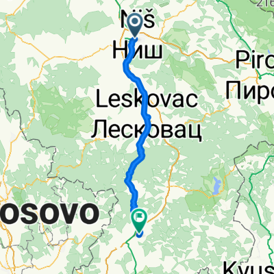
 Niš - Vladičin Han
- Distance
- 79.2 km
- Ascent
- 1,412 m
- Descent
- 958 m
- Location
- Niš, Central Serbia, Serbia
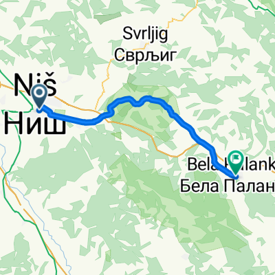 Route from 43.317997N, 21.902896E to Bela Palanka
- Distance
- 43.6 km
- Ascent
- 260 m
- Descent
- 164 m
- Location
- Niš, Central Serbia, Serbia
 K Vis trening 2020-02-29
- Distance
- 33.2 km
- Ascent
- 1,162 m
- Descent
- 1,161 m
- Location
- Niš, Central Serbia, Serbia
 zagrevanje
- Distance
- 32 km
- Ascent
- 346 m
- Descent
- 347 m
- Location
- Niš, Central Serbia, Serbia
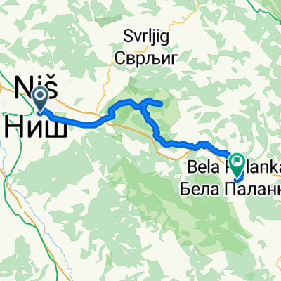 Route from 43.317997N, 21.902896E to Bela Palanka
- Distance
- 56.5 km
- Ascent
- 741 m
- Descent
- 650 m
- Location
- Niš, Central Serbia, Serbia
Open it in the app