
Travail
A cycling route starting in Saint-Médard-en-Jalles, Nouvelle-Aquitaine, France.
Overview
About this route
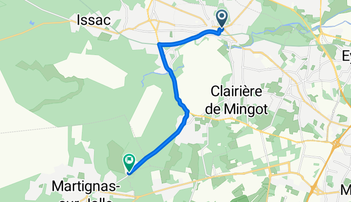
Welcome to a scenic cycling adventure through the heart of Saint-Médard-en-Jalles! Start your journey at the charming 24 Avenue de la Boétie, where the ride begins with a gentle introduction to the route. As you pedal along the paved paths, enjoy the smooth surface that covers a vast majority of your ride, with over 78% of the distance under this category.
The first half of your journey is on the well-maintained bike network, providing a pleasant and safe experience. The Régional bike network will guide you through picturesque surroundings, with the paved surfaces ensuring a comfortable ride.
As you continue, prepare for a slight elevation challenge with a maximum elevation of 42 meters. The ascent is manageable, with only 37 meters of climb and a descent of 16 meters to ease the way.
Your route also includes a mix of unpaved paths, adding variety and a touch of adventure. These sections are well-defined, ensuring you stay on track.
The journey concludes at B 2 C, 2 Chemin de Monfaucon, 33127 Martignas-sur-Jalle, France. This endpoint marks the end of your ride, offering a sense of accomplishment and the opportunity to explore the local area further.
This cycling route is perfect for those looking to enjoy a mix of paved and unpaved paths, offering both comfort and a bit of challenge. Enjoy the ride!
- 29 min
- Duration
- 8.8 km
- Distance
- 37 m
- Ascent
- 16 m
- Descent
- 18.4 km/h
- Avg. speed
- 43 m
- Max. altitude

Route photos

Route quality
Waytypes & surfaces along the route
Waytypes
Cycleway
5.6 km
(64 %)
Road
2.5 km
(29 %)
Surfaces
Paved
7 km
(80 %)
Asphalt
7 km
(80 %)
Undefined
1.8 km
(20 %)
Continue with Bikemap
Use, edit, or download this cycling route
You would like to ride Travail or customize it for your own trip? Here is what you can do with this Bikemap route:
Free features
- Save this route as favorite or in collections
- Copy & plan your own version of this route
- Sync your route with Garmin or Wahoo
Premium features
Free trial for 3 days, or one-time payment. More about Bikemap Premium.
- Navigate this route on iOS & Android
- Export a GPX / KML file of this route
- Create your custom printout (try it for free)
- Download this route for offline navigation
Discover more Premium features.
Get Bikemap PremiumFrom our community
Other popular routes starting in Saint-Médard-en-Jalles
 Day 20/3
- Distance
- 59.6 km
- Ascent
- 35 m
- Descent
- 54 m
- Location
- Saint-Médard-en-Jalles, Nouvelle-Aquitaine, France
 Triple boucle StMedJ
- Distance
- 13.3 km
- Ascent
- 123 m
- Descent
- 123 m
- Location
- Saint-Médard-en-Jalles, Nouvelle-Aquitaine, France
 De Rue Gabriel Garbay 21, Saint-Médard-en-Jalles à Rue Gabriel Garbay 17, Saint-Médard-en-Jalles
- Distance
- 33.7 km
- Ascent
- 421 m
- Descent
- 425 m
- Location
- Saint-Médard-en-Jalles, Nouvelle-Aquitaine, France
 Bouclette du foin
- Distance
- 8 km
- Ascent
- 177 m
- Descent
- 168 m
- Location
- Saint-Médard-en-Jalles, Nouvelle-Aquitaine, France
 De Rue Gustave Gaillard 19, Saint-Médard-en-Jalles à Avenue du Gressier 6, Le Porge
- Distance
- 48.1 km
- Ascent
- 18 m
- Descent
- 18 m
- Location
- Saint-Médard-en-Jalles, Nouvelle-Aquitaine, France
 Saint Medard - Royan
- Distance
- 101.1 km
- Ascent
- 87 m
- Descent
- 110 m
- Location
- Saint-Médard-en-Jalles, Nouvelle-Aquitaine, France
 23 Rue du 92e Bataillon du Génie, Saint-Médard-en-Jalles à 12 Chemin de Tiran, Saint-Médard-en-Jalles
- Distance
- 3.8 km
- Ascent
- 9 m
- Descent
- 16 m
- Location
- Saint-Médard-en-Jalles, Nouvelle-Aquitaine, France
 Sur la Route du Médoc
- Distance
- 10.4 km
- Ascent
- 32 m
- Descent
- 30 m
- Location
- Saint-Médard-en-Jalles, Nouvelle-Aquitaine, France
Open it in the app