

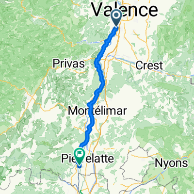
03 Soyons to Vienne 100
A cycling route starting in Soyons, Auvergne-Rhône-Alpes, France.
Overview
About this route
- 5 h 52 min
- Duration
- 100.2 km
- Distance
- 367 m
- Ascent
- 316 m
- Descent
- 17.1 km/h
- Avg. speed
- 172 m
- Max. altitude

Route quality
Waytypes & surfaces along the route
Waytypes
Cycleway
69.2 km
(69 %)
Quiet road
17 km
(17 %)
Surfaces
Paved
75.2 km
(75 %)
Unpaved
7 km
(7 %)
Asphalt
74.2 km
(74 %)
Gravel
4 km
(4 %)
Continue with Bikemap
Use, edit, or download this cycling route
You would like to ride 03 Soyons to Vienne 100 or customize it for your own trip? Here is what you can do with this Bikemap route:
Free features
- Save this route as favorite or in collections
- Copy & plan your own version of this route
- Split it into stages to create a multi-day tour
- Sync your route with Garmin or Wahoo
Premium features
Free trial for 3 days, or one-time payment. More about Bikemap Premium.
- Navigate this route on iOS & Android
- Export a GPX / KML file of this route
- Create your custom printout (try it for free)
- Download this route for offline navigation
Discover more Premium features.
Get Bikemap PremiumFrom our community
Other popular routes starting in Soyons
 Valence - Câteauneuf sur Rhône
- Distance
- 50.5 km
- Ascent
- 303 m
- Descent
- 306 m
- Location
- Soyons, Auvergne-Rhône-Alpes, France
 1 Soyons - Viviers
- Distance
- 64.2 km
- Ascent
- 140 m
- Descent
- 185 m
- Location
- Soyons, Auvergne-Rhône-Alpes, France
 1 Chemin des Sportifs, Soyons to Rue de l'Hôtel de Ville, Le Pouzin
- Distance
- 24 km
- Ascent
- 76 m
- Descent
- 82 m
- Location
- Soyons, Auvergne-Rhône-Alpes, France
 2016 Ride Day 153 - Valence to Donzère
- Distance
- 78.7 km
- Ascent
- 456 m
- Descent
- 504 m
- Location
- Soyons, Auvergne-Rhône-Alpes, France
 STB_Barca_act_008_0812_Valence_Orange
- Distance
- 112.1 km
- Ascent
- 278 m
- Descent
- 321 m
- Location
- Soyons, Auvergne-Rhône-Alpes, France
 Test route
- Distance
- 37.9 km
- Ascent
- 539 m
- Descent
- 539 m
- Location
- Soyons, Auvergne-Rhône-Alpes, France
 valence/vierzon juillet 2012
- Distance
- 495.1 km
- Ascent
- 2,536 m
- Descent
- 2,547 m
- Location
- Soyons, Auvergne-Rhône-Alpes, France
 Soyons - Bourg-Saint-Andéol
- Distance
- 78.5 km
- Ascent
- 277 m
- Descent
- 333 m
- Location
- Soyons, Auvergne-Rhône-Alpes, France
Open it in the app