![소하동Ph0]으로 라우팅](https://media.bikemap.net/routes/17625573/staticmaps/in_89ecc570-cdb9-4040-8afe-cffb17f5744c_694x400_bikemap-2021-3D-static.png)

![소하동Ph0]으로 라우팅](https://media.bikemap.net/routes/17625573/gallery/thumbs/2a3c9ec6-ac28-4449-bb7b-e0a78a0b8bb1.jpg.208x208_q80_crop.jpg)
소하동Ph0]으로 라우팅
- 27.9 km
- 67 m
- 84 m
- Gwangmyeong, Gyeonggi-do, South Korea
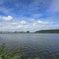
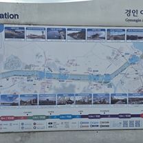
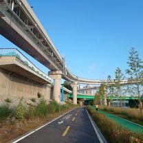
A cycling route starting in Gwangmyeong, Gyeonggi-do, South Korea.
Overview
created this 2 months ago
![Photo 1 of the Bikemap route "소하동Ph0]으로 라우팅"](https://media.bikemap.net/routes/17625573/gallery/thumbs/2a3c9ec6-ac28-4449-bb7b-e0a78a0b8bb1.jpg.688x400_q80_crop.jpg "Photo 1 of the Bikemap route \"소하동Ph0]으로 라우팅\"")
![Photo 2 of the Bikemap route "소하동Ph0]으로 라우팅"](https://media.bikemap.net/routes/17625573/gallery/thumbs/70c5481f-057d-468b-a8ff-b1c732df712d.jpg.688x400_q80_crop.jpg "Photo 2 of the Bikemap route \"소하동Ph0]으로 라우팅\"")
![Photo 3 of the Bikemap route "소하동Ph0]으로 라우팅"](https://media.bikemap.net/routes/17625573/gallery/thumbs/8a5f2983-7ed0-411b-9db1-63144590d6ea.jpg.208x208_q80_crop.jpg "Photo 3 of the Bikemap route \"소하동Ph0]으로 라우팅\"")
![Photo 4 of the Bikemap route "소하동Ph0]으로 라우팅"](https://media.bikemap.net/routes/17625573/gallery/thumbs/82754b50-e6cc-423c-8587-a319c80fe64c.jpg.208x208_q80_crop.jpg "Photo 4 of the Bikemap route \"소하동Ph0]으로 라우팅\"")
![Photo 5 of the Bikemap route "소하동Ph0]으로 라우팅"](https://media.bikemap.net/routes/17625573/gallery/thumbs/8f7fca57-9f5f-4ba1-b760-17a3fb2a1150.jpg.208x208_q80_crop.jpg "Photo 5 of the Bikemap route \"소하동Ph0]으로 라우팅\"")
![Photo 6 of the Bikemap route "소하동Ph0]으로 라우팅"](https://media.bikemap.net/routes/17625573/gallery/thumbs/cd5109da-43d0-43bb-b8e1-a325768e0f95.jpg.208x208_q80_crop.jpg "Photo 6 of the Bikemap route \"소하동Ph0]으로 라우팅\"")
![Photo 7 of the Bikemap route "소하동Ph0]으로 라우팅"](https://media.bikemap.net/routes/17625573/gallery/thumbs/021384e4-e9df-4fd9-b1cd-85014e22b992.jpg.208x208_q80_crop.jpg "Photo 7 of the Bikemap route \"소하동Ph0]으로 라우팅\"")
![Photo 8 of the Bikemap route "소하동Ph0]으로 라우팅"](https://media.bikemap.net/routes/17625573/gallery/thumbs/067453c6-b96f-424c-a9b7-7e3c1c6f8e12.jpg.208x208_q80_crop.jpg "Photo 8 of the Bikemap route \"소하동Ph0]으로 라우팅\"")
Continue with Bikemap
You would like to ride 소하동Ph0]으로 라우팅 or customize it for your own trip? Here is what you can do with this Bikemap route:
Free trial for 3 days, or one-time payment. More about Bikemap Premium.
Discover more Premium features.
Get Bikemap PremiumFrom our community
Open it in the app