
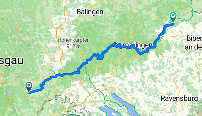
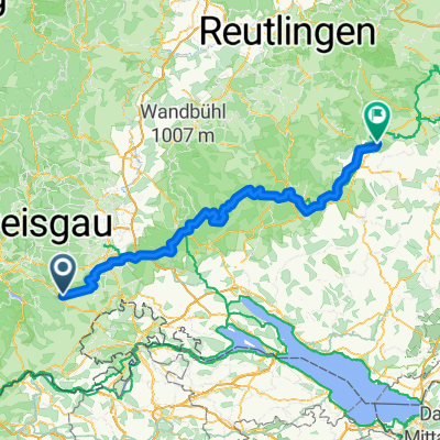
Von Bonndorf im Schwarzwald bis Beuron
A cycling route starting in Bonndorf, Baden-Wurttemberg, Germany.
Overview
About this route
- 11 h 14 min
- Duration
- 153.9 km
- Distance
- 1,785 m
- Ascent
- 2,082 m
- Descent
- 13.7 km/h
- Avg. speed
- 880 m
- Max. altitude
Route quality
Waytypes & surfaces along the route
Waytypes
Track
33.9 km
(22 %)
Road
30.8 km
(20 %)
Surfaces
Paved
120 km
(78 %)
Unpaved
9.2 km
(6 %)
Asphalt
112.3 km
(73 %)
Paved (undefined)
7.7 km
(5 %)
Continue with Bikemap
Use, edit, or download this cycling route
You would like to ride Von Bonndorf im Schwarzwald bis Beuron or customize it for your own trip? Here is what you can do with this Bikemap route:
Free features
- Save this route as favorite or in collections
- Copy & plan your own version of this route
- Split it into stages to create a multi-day tour
- Sync your route with Garmin or Wahoo
Premium features
Free trial for 3 days, or one-time payment. More about Bikemap Premium.
- Navigate this route on iOS & Android
- Export a GPX / KML file of this route
- Create your custom printout (try it for free)
- Download this route for offline navigation
Discover more Premium features.
Get Bikemap PremiumFrom our community
Other popular routes starting in Bonndorf
 Von Bonndorf im Schwarzwald bis Beuron
- Distance
- 153.9 km
- Ascent
- 1,785 m
- Descent
- 2,082 m
- Location
- Bonndorf, Baden-Wurttemberg, Germany
 Auf dem Bähnleweg mit Adrian und Karin
- Distance
- 31.5 km
- Ascent
- 209 m
- Descent
- 225 m
- Location
- Bonndorf, Baden-Wurttemberg, Germany
 Titisee-Feldberg-Schluchsee 2010
- Distance
- 66.8 km
- Ascent
- 841 m
- Descent
- 846 m
- Location
- Bonndorf, Baden-Wurttemberg, Germany
 Route in Bonndorf im Schwarzwald
- Distance
- 50.5 km
- Ascent
- 1,074 m
- Descent
- 1,076 m
- Location
- Bonndorf, Baden-Wurttemberg, Germany
 Schluchtensteig Etappe 3 von der Schattenmühle nach Fischbach-Schluchsee
- Distance
- 18.2 km
- Ascent
- 882 m
- Descent
- 495 m
- Location
- Bonndorf, Baden-Wurttemberg, Germany
 KA-ZH Teil-4 neu Bonndorf-Küssnach-Zürich
- Distance
- 78.4 km
- Ascent
- 410 m
- Descent
- 786 m
- Location
- Bonndorf, Baden-Wurttemberg, Germany
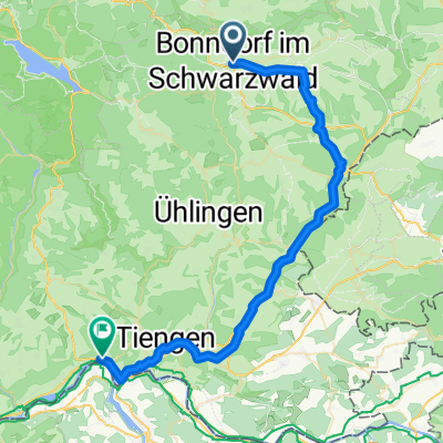 Von Bonndorf im Schwarzwald bis Waldshut-Tiengen
- Distance
- 46.4 km
- Ascent
- 387 m
- Descent
- 897 m
- Location
- Bonndorf, Baden-Wurttemberg, Germany
 Bonndorf - Dillendorf- Boll
- Distance
- 22.4 km
- Ascent
- 518 m
- Descent
- 529 m
- Location
- Bonndorf, Baden-Wurttemberg, Germany
Open it in the app