
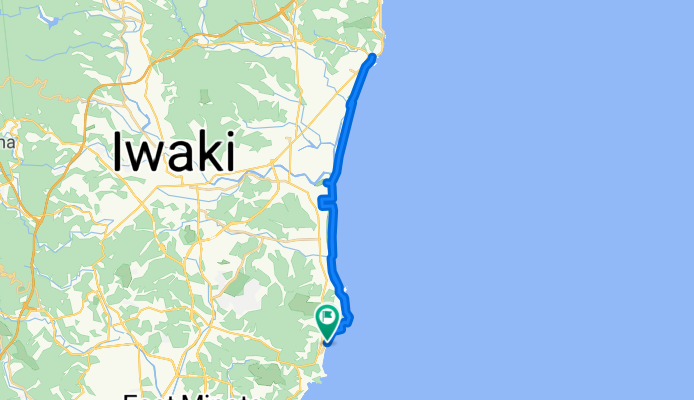
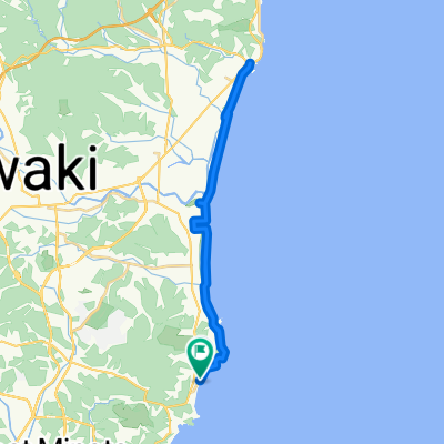
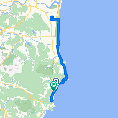
県道382号, いわき市へ県道382号, いわき市
A cycling route starting in Iwaki, Fukushima, Japan.
Overview
About this route
- 2 h 13 min
- Duration
- 34.4 km
- Distance
- 111 m
- Ascent
- 137 m
- Descent
- 15.5 km/h
- Avg. speed
- 28 m
- Max. altitude
Continue with Bikemap
Use, edit, or download this cycling route
You would like to ride 県道382号, いわき市へ県道382号, いわき市 or customize it for your own trip? Here is what you can do with this Bikemap route:
Free features
- Save this route as favorite or in collections
- Copy & plan your own version of this route
- Sync your route with Garmin or Wahoo
Premium features
Free trial for 3 days, or one-time payment. More about Bikemap Premium.
- Navigate this route on iOS & Android
- Export a GPX / KML file of this route
- Create your custom printout (try it for free)
- Download this route for offline navigation
Discover more Premium features.
Get Bikemap PremiumFrom our community
Other popular routes starting in Iwaki
 県道382号, いわき市へ県道382号, いわき市
- Distance
- 34.4 km
- Ascent
- 111 m
- Descent
- 137 m
- Location
- Iwaki, Fukushima, Japan
 Cycle 4: Iwaki - Hitachi
- Distance
- 69.1 km
- Ascent
- 333 m
- Descent
- 307 m
- Location
- Iwaki, Fukushima, Japan
 Day - 10 Iwaki Masjid to Tsukuba Masjid (16/10/19)
- Distance
- 143.3 km
- Ascent
- 0 m
- Descent
- 0 m
- Location
- Iwaki, Fukushima, Japan
 Onigoe, Iwaki to Onigoe, Iwaki
- Distance
- 5.3 km
- Ascent
- 86 m
- Descent
- 86 m
- Location
- Iwaki, Fukushima, Japan
 泉もえぎ台3丁目14-1, いわき市 to 中野高田39, 双葉郡双葉町
- Distance
- 217.1 km
- Ascent
- 4,575 m
- Descent
- 4,596 m
- Location
- Iwaki, Fukushima, Japan
 県道382号, いわき市へ県道382号, いわき市
- Distance
- 19.5 km
- Ascent
- 109 m
- Descent
- 114 m
- Location
- Iwaki, Fukushima, Japan
 Iwaki-Koriyama
- Distance
- 73.1 km
- Ascent
- 718 m
- Descent
- 496 m
- Location
- Iwaki, Fukushima, Japan
 県道382号, いわき市へ県道382号, いわき市
- Distance
- 17.8 km
- Ascent
- 69 m
- Descent
- 64 m
- Location
- Iwaki, Fukushima, Japan
Open it in the app