
ASCENSO AL MONT SAINT-CLAIR
Cycling route
Overview
About this route
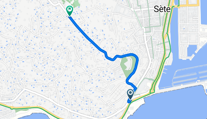
El Mont Saint-Clair, situado en el corazón de Sète (Francia), es un ascenso tan breve como explosivo, con apenas 2,2 km de recorrido, pero con rampas que llegan al 15%. La subida está íntimamente ligada al santuario de Notre-Dame de la Salette, que corona la cima y se erige como un faro espiritual y arquitectónico, visible desde buena parte de la ciudad y de la costa.
- 13 min
- Duration
- 1.7 km
- Distance
- 167 m
- Ascent
- 0 m
- Descent
- 7.6 km/h
- Avg. speed
- 172 m
- Max. altitude

Route photos

Route quality
Waytypes & surfaces along the route
Waytypes
Road
1.6 km
(96 %)
Quiet road
0.1 km
(4 %)
Surfaces
Paved
1.6 km
(99 %)
Asphalt
1.6 km
(99 %)
Undefined
0 km
(1 %)
Continue with Bikemap
Use, edit, or download this cycling route
You would like to ride ASCENSO AL MONT SAINT-CLAIR or customize it for your own trip? Here is what you can do with this Bikemap route:
Free features
- Save this route as favorite or in collections
- Copy & plan your own version of this route
- Sync your route with Garmin or Wahoo
Premium features
Free trial for 3 days, or one-time payment. More about Bikemap Premium.
- Navigate this route on iOS & Android
- Export a GPX / KML file of this route
- Create your custom printout (try it for free)
- Download this route for offline navigation
Discover more Premium features.
Get Bikemap PremiumOpen it in the app