
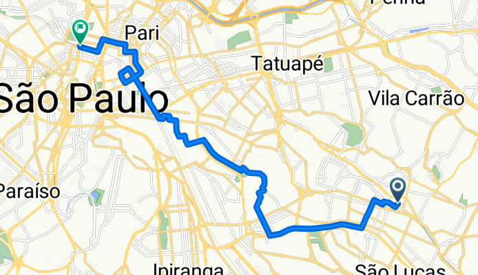
caminho melhor para mim
A cycling route starting in São Caetano do Sul, São Paulo, Brazil.
Overview
About this route
- 57 min
- Duration
- 16.7 km
- Distance
- 132 m
- Ascent
- 161 m
- Descent
- 17.6 km/h
- Avg. speed
- 805 m
- Max. altitude

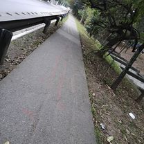
Route quality
Waytypes & surfaces along the route
Waytypes
Quiet road
6.5 km
(39 %)
Road
5.9 km
(35 %)
Surfaces
Paved
16.6 km
(99 %)
Asphalt
13.9 km
(83 %)
Concrete
2.7 km
(16 %)
Undefined
0.2 km
(1 %)
Continue with Bikemap
Use, edit, or download this cycling route
You would like to ride caminho melhor para mim or customize it for your own trip? Here is what you can do with this Bikemap route:
Free features
- Save this route as favorite or in collections
- Copy & plan your own version of this route
- Sync your route with Garmin or Wahoo
Premium features
Free trial for 3 days, or one-time payment. More about Bikemap Premium.
- Navigate this route on iOS & Android
- Export a GPX / KML file of this route
- Create your custom printout (try it for free)
- Download this route for offline navigation
Discover more Premium features.
Get Bikemap PremiumFrom our community
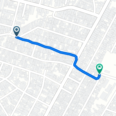
Other popular routes starting in São Caetano do Sul
 De Rua Doresópolis a Rua Doresópolis
- Distance
- 14 km
- Ascent
- 325 m
- Descent
- 329 m
- Location
- São Caetano do Sul, São Paulo, Brazil
 De Rua Palmeira Bacaba 277 a Rua Alfavaca 81
- Distance
- 76.5 km
- Ascent
- 445 m
- Descent
- 495 m
- Location
- São Caetano do Sul, São Paulo, Brazil
 Treino Dib - Roseira
- Distance
- 64.7 km
- Ascent
- 692 m
- Descent
- 692 m
- Location
- São Caetano do Sul, São Paulo, Brazil
 De Avenida Professor Edgar Santos a Avenida Professor Edgar Santos
- Distance
- 4 km
- Ascent
- 107 m
- Descent
- 120 m
- Location
- São Caetano do Sul, São Paulo, Brazil
 De Avenida Montemagno a Rua Rei Alberto da Bélgica
- Distance
- 0.8 km
- Ascent
- 45 m
- Descent
- 23 m
- Location
- São Caetano do Sul, São Paulo, Brazil
 De Avenida Afonso de Sampaio e Sousa a Avenida Afonso de Sampaio e Sousa
- Distance
- 2.4 km
- Ascent
- 57 m
- Descent
- 27 m
- Location
- São Caetano do Sul, São Paulo, Brazil
 De Avenida Padre Arlindo Vieira 894 a Rua Leo de Morais 242
- Distance
- 36.2 km
- Ascent
- 150 m
- Descent
- 299 m
- Location
- São Caetano do Sul, São Paulo, Brazil
 Loop São Caetano x São Bernardo
- Distance
- 32.3 km
- Ascent
- 191 m
- Descent
- 190 m
- Location
- São Caetano do Sul, São Paulo, Brazil
Open it in the app