
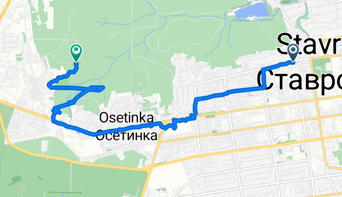
Покатушка
A cycling route starting in Stavropol, Stavropol Kray, Russia.
Overview
About this route
- < 1 min
- Duration
- 7.1 km
- Distance
- 105 m
- Ascent
- 72 m
- Descent
- 4,275.6 km/h
- Avg. speed
- 640 m
- Max. altitude

Continue with Bikemap
Use, edit, or download this cycling route
You would like to ride Покатушка or customize it for your own trip? Here is what you can do with this Bikemap route:
Free features
- Save this route as favorite or in collections
- Copy & plan your own version of this route
- Sync your route with Garmin or Wahoo
Premium features
Free trial for 3 days, or one-time payment. More about Bikemap Premium.
- Navigate this route on iOS & Android
- Export a GPX / KML file of this route
- Create your custom printout (try it for free)
- Download this route for offline navigation
Discover more Premium features.
Get Bikemap PremiumFrom our community
Other popular routes starting in Stavropol
 маршрут из улица Пушкина 20, Ставрополь
- Distance
- 23.8 km
- Ascent
- 161 m
- Descent
- 515 m
- Location
- Stavropol, Stavropol Kray, Russia
 Покатушка
- Distance
- 7.1 km
- Ascent
- 105 m
- Descent
- 72 m
- Location
- Stavropol, Stavropol Kray, Russia
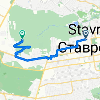
 От улица Пирогова 5А к2 до улица Васильева
- Distance
- 75.1 km
- Ascent
- 917 m
- Descent
- 938 m
- Location
- Stavropol, Stavropol Kray, Russia
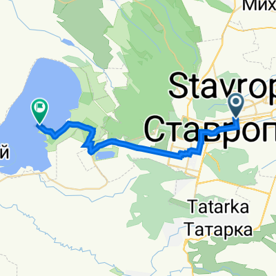
 Route to Stavropol
- Distance
- 17.3 km
- Ascent
- 107 m
- Descent
- 108 m
- Location
- Stavropol, Stavropol Kray, Russia
 От улица Пирогова 18/7, Ставрополь до Татарка
- Distance
- 6.7 km
- Ascent
- 18 m
- Descent
- 137 m
- Location
- Stavropol, Stavropol Kray, Russia
 Новокавказский мост
- Distance
- 37.3 km
- Ascent
- 803 m
- Descent
- 806 m
- Location
- Stavropol, Stavropol Kray, Russia
 Дом торговли - Вшивое озеро - Дом торговли
- Distance
- 35.7 km
- Ascent
- 437 m
- Descent
- 437 m
- Location
- Stavropol, Stavropol Kray, Russia
 Водоканал - Беспутские поляны - водоканал
- Distance
- 16.8 km
- Ascent
- 138 m
- Descent
- 138 m
- Location
- Stavropol, Stavropol Kray, Russia
Open it in the app