
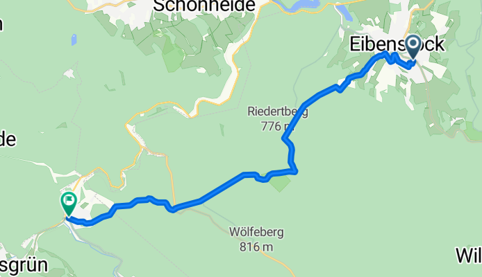
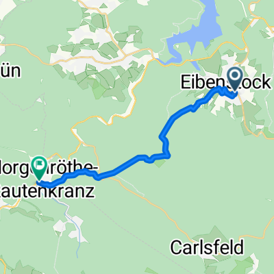
Auersbergstraße nach Rautenkranz
A cycling route starting in Eibenstock, Saxony, Germany.
Overview
About this route
- 46 min
- Duration
- 11.7 km
- Distance
- 283 m
- Ascent
- 319 m
- Descent
- 15.1 km/h
- Avg. speed
- 782 m
- Max. altitude
Route quality
Waytypes & surfaces along the route
Waytypes
Track
8.5 km
(73 %)
Quiet road
2.7 km
(23 %)
Surfaces
Paved
8.2 km
(70 %)
Unpaved
2.4 km
(21 %)
Asphalt
7.9 km
(68 %)
Gravel
1.7 km
(15 %)
Continue with Bikemap
Use, edit, or download this cycling route
You would like to ride Auersbergstraße nach Rautenkranz or customize it for your own trip? Here is what you can do with this Bikemap route:
Free features
- Save this route as favorite or in collections
- Copy & plan your own version of this route
- Sync your route with Garmin or Wahoo
Premium features
Free trial for 3 days, or one-time payment. More about Bikemap Premium.
- Navigate this route on iOS & Android
- Export a GPX / KML file of this route
- Create your custom printout (try it for free)
- Download this route for offline navigation
Discover more Premium features.
Get Bikemap PremiumFrom our community
Other popular routes starting in Eibenstock
 Auersbergstraße nach Rautenkranz
- Distance
- 11.7 km
- Ascent
- 283 m
- Descent
- 319 m
- Location
- Eibenstock, Saxony, Germany
 Rundtour Eibenstock-Riesenberger Häuser-Kammweg-Carlsfeld
- Distance
- 33.7 km
- Ascent
- 484 m
- Descent
- 484 m
- Location
- Eibenstock, Saxony, Germany
 Himmelfahrt 2020 "Jungs"
- Distance
- 40.4 km
- Ascent
- 429 m
- Descent
- 427 m
- Location
- Eibenstock, Saxony, Germany
 Route von Muldenstraße, Eibenstock
- Distance
- 7.5 km
- Ascent
- 329 m
- Descent
- 246 m
- Location
- Eibenstock, Saxony, Germany
 Eibenstock-Blauenthaler Wasserfall-Auersberg-Carlsfeld
- Distance
- 37.1 km
- Ascent
- 743 m
- Descent
- 743 m
- Location
- Eibenstock, Saxony, Germany
 Eibenstock-Blauenthaler Wasserfall-Auersberg-Carlsfeld
- Distance
- 36.4 km
- Ascent
- 743 m
- Descent
- 743 m
- Location
- Eibenstock, Saxony, Germany
 Carlsfelder Hauptstraße 11, Eibenstock nach Carlsfeld, Hauptstr, Eibenstock
- Distance
- 10.4 km
- Ascent
- 228 m
- Descent
- 228 m
- Location
- Eibenstock, Saxony, Germany
 Eibenstock-Sosa-Eibenstock
- Distance
- 19.7 km
- Ascent
- 399 m
- Descent
- 390 m
- Location
- Eibenstock, Saxony, Germany
Open it in the app