

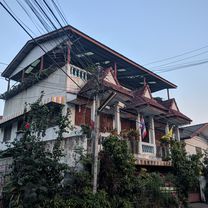
MTCM - ITT Huay Tung Thao Lake
A cycling route starting in Chiang Mai, Chiang Mai, Thailand.
Overview
About this route
Masters Tour of Chiang Mai Rajabhat University 2012 - Stage 3 - Individual Time Trial - flat but technically challenging
- -:--
- Duration
- 8.3 km
- Distance
- 72 m
- Ascent
- 78 m
- Descent
- ---
- Avg. speed
- ---
- Max. altitude

Route quality
Waytypes & surfaces along the route
Waytypes
Quiet road
3.2 km
(39 %)
Cycleway
2.8 km
(34 %)
Surfaces
Paved
8.1 km
(98 %)
Asphalt
8 km
(96 %)
Paved (undefined)
0.2 km
(2 %)
Undefined
0.2 km
(2 %)
Continue with Bikemap
Use, edit, or download this cycling route
You would like to ride MTCM - ITT Huay Tung Thao Lake or customize it for your own trip? Here is what you can do with this Bikemap route:
Free features
- Save this route as favorite or in collections
- Copy & plan your own version of this route
- Sync your route with Garmin or Wahoo
Premium features
Free trial for 3 days, or one-time payment. More about Bikemap Premium.
- Navigate this route on iOS & Android
- Export a GPX / KML file of this route
- Create your custom printout (try it for free)
- Download this route for offline navigation
Discover more Premium features.
Get Bikemap PremiumFrom our community
Other popular routes starting in Chiang Mai
 Doi Suthep climg
- Distance
- 34.4 km
- Ascent
- 713 m
- Descent
- 707 m
- Location
- Chiang Mai, Chiang Mai, Thailand
 Chiang Mai East Loop
- Distance
- 81 km
- Ascent
- 363 m
- Descent
- 364 m
- Location
- Chiang Mai, Chiang Mai, Thailand
 biking in Chiang Mai
- Distance
- 5.2 km
- Ascent
- 207 m
- Descent
- 202 m
- Location
- Chiang Mai, Chiang Mai, Thailand
 Chiang Mai City and Royal Floral Park (Motorbike)
- Distance
- 22.1 km
- Ascent
- 373 m
- Descent
- 379 m
- Location
- Chiang Mai, Chiang Mai, Thailand
 Supersonic route in Chiang Mai
- Distance
- 11.7 km
- Ascent
- 160 m
- Descent
- 131 m
- Location
- Chiang Mai, Chiang Mai, Thailand
 Chiang Mai - Huey Tueng Tao See
- Distance
- 39.5 km
- Ascent
- 101 m
- Descent
- 102 m
- Location
- Chiang Mai, Chiang Mai, Thailand
 J19-chiang Maï - Mae kachan
- Distance
- 85.3 km
- Ascent
- 755 m
- Descent
- 480 m
- Location
- Chiang Mai, Chiang Mai, Thailand
 straight to samoeng
- Distance
- 41.2 km
- Ascent
- 1,028 m
- Descent
- 849 m
- Location
- Chiang Mai, Chiang Mai, Thailand
Open it in the app