

De Don Benito a Santa Cruz de la Sierra por Herguijuela
A cycling route starting in Don Benito, Extremadura, Spain.
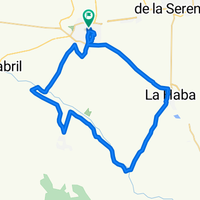
Overview
About this route
Interesante recorrido para hacerlo a buen ritmo. No es montañoso pero tampoco llano, zona de gbaja sierra en el intermedio con carretera insinuosa y tramo final de rectas largas aptas para marcar buenas medias. 120 Km donde el aire puede ser un buen aliado o un atroz enemigo.
- -:--
- Duration
- 119.4 km
- Distance
- 359 m
- Ascent
- 368 m
- Descent
- ---
- Avg. speed
- ---
- Max. altitude
Continue with Bikemap
Use, edit, or download this cycling route
You would like to ride De Don Benito a Santa Cruz de la Sierra por Herguijuela or customize it for your own trip? Here is what you can do with this Bikemap route:
Free features
- Save this route as favorite or in collections
- Copy & plan your own version of this route
- Split it into stages to create a multi-day tour
- Sync your route with Garmin or Wahoo
Premium features
Free trial for 3 days, or one-time payment. More about Bikemap Premium.
- Navigate this route on iOS & Android
- Export a GPX / KML file of this route
- Create your custom printout (try it for free)
- Download this route for offline navigation
Discover more Premium features.
Get Bikemap PremiumFrom our community
Other popular routes starting in Don Benito
 Paliza para empezar
- Distance
- 31.5 km
- Ascent
- 271 m
- Descent
- 245 m
- Location
- Don Benito, Extremadura, Spain
 De Don Benito a Santa Cruz de la Sierra por Herguijuela
- Distance
- 119.4 km
- Ascent
- 359 m
- Descent
- 368 m
- Location
- Don Benito, Extremadura, Spain


 Mengabril, Medellin
- Distance
- 31.1 km
- Ascent
- 60 m
- Descent
- 77 m
- Location
- Don Benito, Extremadura, Spain
 XLV edición - Circuito del Guadiana (V Copa de España)
- Distance
- 42.3 km
- Ascent
- 295 m
- Descent
- 295 m
- Location
- Don Benito, Extremadura, Spain
 Magacela-Camino REal
- Distance
- 70.2 km
- Ascent
- 491 m
- Descent
- 498 m
- Location
- Don Benito, Extremadura, Spain
Open it in the app