
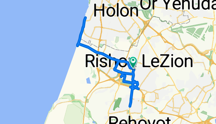
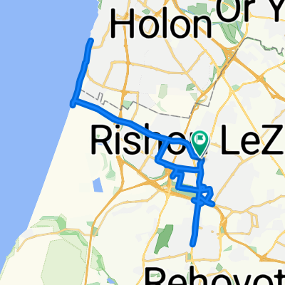
כיפור 25
A cycling route starting in Rishon LeZiyyon, Central District, Israel.
Overview
About this route
- 2 h 59 min
- Duration
- 41.4 km
- Distance
- 235 m
- Ascent
- 251 m
- Descent
- 13.9 km/h
- Avg. speed
- 71 m
- Max. altitude
Continue with Bikemap
Use, edit, or download this cycling route
You would like to ride כיפור 25 or customize it for your own trip? Here is what you can do with this Bikemap route:
Free features
- Save this route as favorite or in collections
- Copy & plan your own version of this route
- Sync your route with Garmin or Wahoo
Premium features
Free trial for 3 days, or one-time payment. More about Bikemap Premium.
- Navigate this route on iOS & Android
- Export a GPX / KML file of this route
- Create your custom printout (try it for free)
- Download this route for offline navigation
Discover more Premium features.
Get Bikemap PremiumFrom our community
Other popular routes starting in Rishon LeZiyyon
 to work
- Distance
- 16.6 km
- Ascent
- 71 m
- Descent
- 123 m
- Location
- Rishon LeZiyyon, Central District, Israel
 מסלול ריצה לאורך כביש 412
- Distance
- 7.9 km
- Ascent
- 53 m
- Descent
- 59 m
- Location
- Rishon LeZiyyon, Central District, Israel
 כיפור 25
- Distance
- 41.4 km
- Ascent
- 235 m
- Descent
- 251 m
- Location
- Rishon LeZiyyon, Central District, Israel
 סובב נס הרים
- Distance
- 129.2 km
- Ascent
- 941 m
- Descent
- 967 m
- Location
- Rishon LeZiyyon, Central District, Israel
 ראשון רחובות גדרה עשרת
- Distance
- 51 km
- Ascent
- 193 m
- Descent
- 193 m
- Location
- Rishon LeZiyyon, Central District, Israel
 סובב שכונות מערב ראשון לציון
- Distance
- 11.8 km
- Ascent
- 65 m
- Descent
- 67 m
- Location
- Rishon LeZiyyon, Central District, Israel
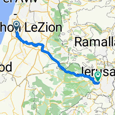 road to Jerusalem
- Distance
- 63 km
- Ascent
- 1,440 m
- Descent
- 661 m
- Location
- Rishon LeZiyyon, Central District, Israel
 GOSTY to Petah Tikva
- Distance
- 18.1 km
- Ascent
- 68 m
- Descent
- 64 m
- Location
- Rishon LeZiyyon, Central District, Israel
Open it in the app