
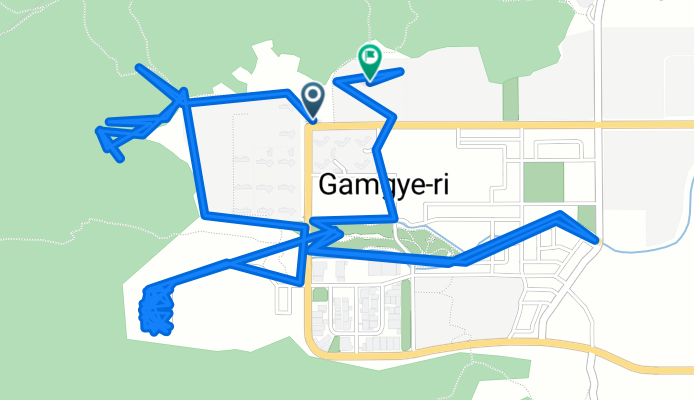
북면 ~ 북면
A cycling route starting in Naesŏ, Gyeongsangnam-do, South Korea.
Overview
About this route
- 1 h 36 min
- Duration
- 14.6 km
- Distance
- 279 m
- Ascent
- 297 m
- Descent
- 9.1 km/h
- Avg. speed
- 208 m
- Max. altitude
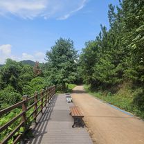
Route photos


Continue with Bikemap
Use, edit, or download this cycling route
You would like to ride 북면 ~ 북면 or customize it for your own trip? Here is what you can do with this Bikemap route:
Free features
- Save this route as favorite or in collections
- Copy & plan your own version of this route
- Sync your route with Garmin or Wahoo
Premium features
Free trial for 3 days, or one-time payment. More about Bikemap Premium.
- Navigate this route on iOS & Android
- Export a GPX / KML file of this route
- Create your custom printout (try it for free)
- Download this route for offline navigation
Discover more Premium features.
Get Bikemap PremiumFrom our community
Other popular routes starting in Naesŏ
 남지읍 662−33, 창녕군 to 남지읍 814−5, 창녕군
- Distance
- 7.9 km
- Ascent
- 14 m
- Descent
- 37 m
- Location
- Naesŏ, Gyeongsangnam-do, South Korea
 Chilbuk-myeon 581-8, Haman to Daesan-myeon 88-15
- Distance
- 19.9 km
- Ascent
- 15 m
- Descent
- 11 m
- Location
- Naesŏ, Gyeongsangnam-do, South Korea
 Beyond Busan
- Distance
- 409.5 km
- Ascent
- 3,530 m
- Descent
- 3,539 m
- Location
- Naesŏ, Gyeongsangnam-do, South Korea
 내서읍 624−1 to 길곡면, 창녕군
- Distance
- 25 km
- Ascent
- 389 m
- Descent
- 455 m
- Location
- Naesŏ, Gyeongsangnam-do, South Korea
 2025.8.23 9시15~13.15분 창녕함안보 ㅡ합천창녕보
- Distance
- 55.6 km
- Ascent
- 469 m
- Descent
- 508 m
- Location
- Naesŏ, Gyeongsangnam-do, South Korea
 북면 ~ 북면
- Distance
- 14.6 km
- Ascent
- 279 m
- Descent
- 297 m
- Location
- Naesŏ, Gyeongsangnam-do, South Korea
 남지읍 952-14, 창녕군 ~ 남지읍 662-23, 창녕군
- Distance
- 9.1 km
- Ascent
- 14 m
- Descent
- 51 m
- Location
- Naesŏ, Gyeongsangnam-do, South Korea
 Changwon outskirts - Busan
- Distance
- 87.1 km
- Ascent
- 523 m
- Descent
- 527 m
- Location
- Naesŏ, Gyeongsangnam-do, South Korea
Open it in the app