
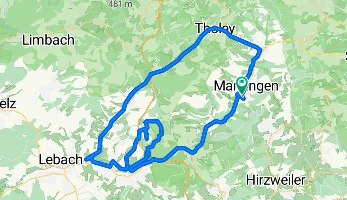
Friedrichstraße nach Am Langenstrank
A cycling route starting in Marpingen, Saarland, Germany.
Overview
About this route
- 2 h 39 min
- Duration
- 40.6 km
- Distance
- 510 m
- Ascent
- 557 m
- Descent
- 15.4 km/h
- Avg. speed
- 387 m
- Max. altitude

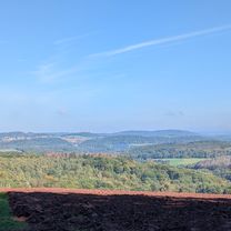
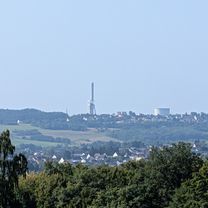
Route photos


Route quality
Waytypes & surfaces along the route
Waytypes
Track
10.1 km
(25 %)
Quiet road
6.1 km
(15 %)
Surfaces
Paved
30.8 km
(76 %)
Unpaved
6.9 km
(17 %)
Asphalt
30 km
(74 %)
Gravel
5.7 km
(14 %)
Continue with Bikemap
Use, edit, or download this cycling route
You would like to ride Friedrichstraße nach Am Langenstrank or customize it for your own trip? Here is what you can do with this Bikemap route:
Free features
- Save this route as favorite or in collections
- Copy & plan your own version of this route
- Sync your route with Garmin or Wahoo
Premium features
Free trial for 3 days, or one-time payment. More about Bikemap Premium.
- Navigate this route on iOS & Android
- Export a GPX / KML file of this route
- Create your custom printout (try it for free)
- Download this route for offline navigation
Discover more Premium features.
Get Bikemap PremiumFrom our community
Other popular routes starting in Marpingen
 Wünschberg Tour
- Distance
- 41.7 km
- Ascent
- 533 m
- Descent
- 533 m
- Location
- Marpingen, Saarland, Germany
 Marpingen - Skulpturenstraße - Bostalsee
- Distance
- 54.7 km
- Ascent
- 602 m
- Descent
- 617 m
- Location
- Marpingen, Saarland, Germany
 Friedrichstraße nach Am Langenstrank
- Distance
- 40.6 km
- Ascent
- 510 m
- Descent
- 557 m
- Location
- Marpingen, Saarland, Germany
 Am Langenstrank nach Am Langenstrank
- Distance
- 35.6 km
- Ascent
- 406 m
- Descent
- 460 m
- Location
- Marpingen, Saarland, Germany
 MTB 5 Sankt Wendeler Land
- Distance
- 21.1 km
- Ascent
- 350 m
- Descent
- 350 m
- Location
- Marpingen, Saarland, Germany
 MTB 5 Sankt Wendeler Land
- Distance
- 21.1 km
- Ascent
- 339 m
- Descent
- 339 m
- Location
- Marpingen, Saarland, Germany
 Marpinger Rundtour
- Distance
- 13.3 km
- Ascent
- 269 m
- Descent
- 269 m
- Location
- Marpingen, Saarland, Germany
 Römeretappe
- Distance
- 47.1 km
- Ascent
- 620 m
- Descent
- 623 m
- Location
- Marpingen, Saarland, Germany
Open it in the app