

Estarli pilgrimage
A cycling route starting in Gosport, England, United Kingdom.
Overview
About this route
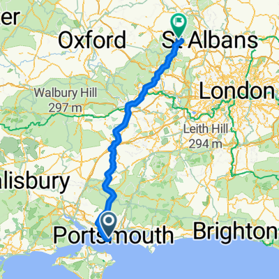
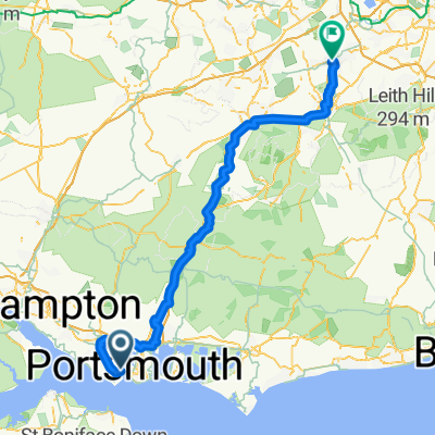
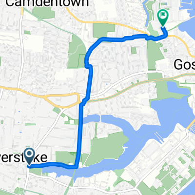
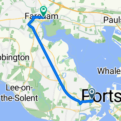
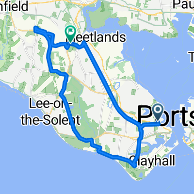
Embark on an exhilarating 159.6 km cycling adventure that promises both challenge and beauty. This route features a total ascent of 1408 meters and a descent of 1301 meters, leading you to a maximum elevation of 206 meters. The journey is divided into two primary surfaces: asphalt, covering 93220 meters, accounting for 58.4% of the route, and undefined terrain, comprising 38760 meters or 24.3%.
Throughout your ride, you'll encounter a variety of way types, including quiet roads, cycleways, and tracks. Quiet roads make up 52.8% of the route at 84274 meters, offering serene stretches for uninterrupted pedaling. Cycleways add an exciting twist, spanning 21.4% of the journey at 34193 meters, while tracks provide a different terrain experience, making up 13.2% of the distance at 21113 meters.
This route is integrated into the National Bike Network, with 38.0% of the journey on paved paths and 39.5% on undefined surfaces. The paved sections ensure a smooth ride, while the undefined portions offer a chance to explore off-road cycling.
Whether you're a seasoned cyclist or a casual rider, this route offers a blend of scenic views and varied terrain, making it perfect for those who thrive on adventure and exploration.
AI generated
- 7 h 43 min
- Duration
- 159.6 km
- Distance
- 1,408 m
- Ascent
- 1,301 m
- Descent
- 20.7 km/h
- Avg. speed
- 206 m
- Max. altitude

Route quality
Waytypes & surfaces along the route
Waytypes
Quiet road
84.6 km
(53 %)
Cycleway
35.1 km
(22 %)
Surfaces
Paved
95.8 km
(60 %)
Unpaved
25.5 km
(16 %)
Asphalt
95.8 km
(60 %)
Gravel
12.8 km
(8 %)
Continue with Bikemap
Use, edit, or download this cycling route
You would like to ride Estarli pilgrimage or customize it for your own trip? Here is what you can do with this Bikemap route:
Free features
- Save this route as favorite or in collections
- Copy & plan your own version of this route
- Split it into stages to create a multi-day tour
- Sync your route with Garmin or Wahoo
Premium features
Free trial for 3 days, or one-time payment. More about Bikemap Premium.
- Navigate this route on iOS & Android
- Export a GPX / KML file of this route
- Create your custom printout (try it for free)
- Download this route for offline navigation
Discover more Premium features.
Get Bikemap PremiumFrom our community
Other popular routes starting in Gosport
 Quick bike tour through Gosport
- Distance
- 8.9 km
- Ascent
- 22 m
- Descent
- 21 m
- Location
- Gosport, England, United Kingdom
 Estarli pilgrimage
- Distance
- 159.6 km
- Ascent
- 1,408 m
- Descent
- 1,301 m
- Location
- Gosport, England, United Kingdom
 Estarli pilgrimage part 1
- Distance
- 108.2 km
- Ascent
- 787 m
- Descent
- 760 m
- Location
- Gosport, England, United Kingdom
 Gosport Loop
- Distance
- 33.8 km
- Ascent
- 65 m
- Descent
- 63 m
- Location
- Gosport, England, United Kingdom
 Charlotte Mews, Gosport to Henry Player Avenue, Gosport
- Distance
- 3.4 km
- Ascent
- 6 m
- Descent
- 6 m
- Location
- Gosport, England, United Kingdom
 Henry Player Avenue, Gosport to High Street, Fareham
- Distance
- 10 km
- Ascent
- 22 m
- Descent
- 22 m
- Location
- Gosport, England, United Kingdom
 Warsash and back
- Distance
- 19.3 km
- Ascent
- 56 m
- Descent
- 61 m
- Location
- Gosport, England, United Kingdom
 Route avoiding Alver Valley
- Distance
- 28.5 km
- Ascent
- 10 m
- Descent
- 6 m
- Location
- Gosport, England, United Kingdom
Open it in the app