
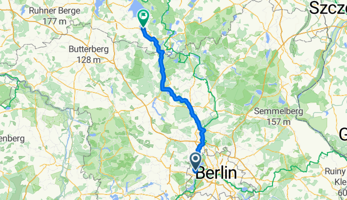
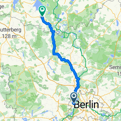
Altstädter Ring, Berlin nach Müritzstraße, Rechlin
A cycling route starting in Spandau, State of Berlin, Germany.
Overview
About this route
Trip with Malin to the Müritz
- 7 h 44 min
- Duration
- 129.8 km
- Distance
- 563 m
- Ascent
- 534 m
- Descent
- 16.8 km/h
- Avg. speed
- 82 m
- Max. altitude

Route quality
Waytypes & surfaces along the route
Waytypes
Path
61 km
(47 %)
Quiet road
23.4 km
(18 %)
Surfaces
Paved
102.5 km
(79 %)
Unpaved
1.3 km
(1 %)
Asphalt
101.2 km
(78 %)
Concrete
1.3 km
(1 %)
Continue with Bikemap
Use, edit, or download this cycling route
You would like to ride Altstädter Ring, Berlin nach Müritzstraße, Rechlin or customize it for your own trip? Here is what you can do with this Bikemap route:
Free features
- Save this route as favorite or in collections
- Copy & plan your own version of this route
- Split it into stages to create a multi-day tour
- Sync your route with Garmin or Wahoo
Premium features
Free trial for 3 days, or one-time payment. More about Bikemap Premium.
- Navigate this route on iOS & Android
- Export a GPX / KML file of this route
- Create your custom printout (try it for free)
- Download this route for offline navigation
Discover more Premium features.
Get Bikemap PremiumFrom our community
Other popular routes starting in Spandau
 Altstädter Ring, Berlin nach Müritzstraße, Rechlin
- Distance
- 129.8 km
- Ascent
- 563 m
- Descent
- 534 m
- Location
- Spandau, State of Berlin, Germany
 Spandau Runde
- Distance
- 9.3 km
- Ascent
- 34 m
- Descent
- 31 m
- Location
- Spandau, State of Berlin, Germany
 Stadtführung Berlin, Radtour durch die westlichen Randgebiete von www.stadtspiele-verlag.de
- Distance
- 50.5 km
- Ascent
- 166 m
- Descent
- 160 m
- Location
- Spandau, State of Berlin, Germany
 Rathaus Spandau - Sacrower Schlosspark und zurück
- Distance
- 48.1 km
- Ascent
- 134 m
- Descent
- 136 m
- Location
- Spandau, State of Berlin, Germany
 am Havelkanal
- Distance
- 31.3 km
- Ascent
- 74 m
- Descent
- 72 m
- Location
- Spandau, State of Berlin, Germany
 Durch den Grunewald
- Distance
- 25.5 km
- Ascent
- 284 m
- Descent
- 279 m
- Location
- Spandau, State of Berlin, Germany
 Tegeler See - Spandau - Rundtour
- Distance
- 19.7 km
- Ascent
- 66 m
- Descent
- 66 m
- Location
- Spandau, State of Berlin, Germany
 4. RTF "Ins Märkische Luch" 153 km / Umleitung
- Distance
- 152.6 km
- Ascent
- 154 m
- Descent
- 154 m
- Location
- Spandau, State of Berlin, Germany
Open it in the app