
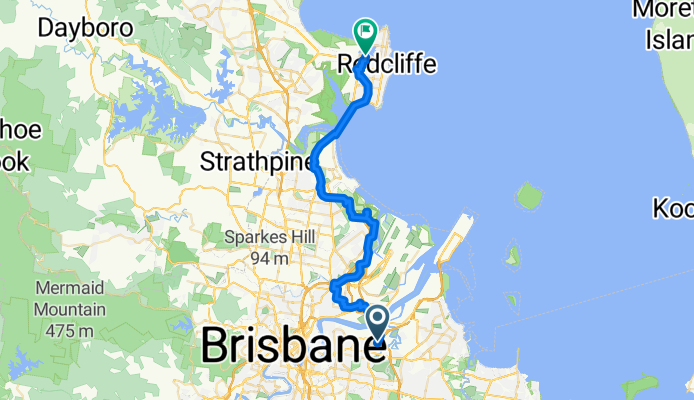
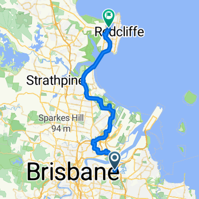
Route to Kippa-Ring
A cycling route starting in Cannon Hill, Queensland, Australia.
Overview
About this route
- 2 h 46 min
- Duration
- 46.4 km
- Distance
- 112 m
- Ascent
- 142 m
- Descent
- 16.8 km/h
- Avg. speed
- 33 m
- Max. altitude
Route quality
Waytypes & surfaces along the route
Waytypes
Cycleway
37.6 km
(81 %)
Quiet road
4.6 km
(10 %)
Surfaces
Paved
41.3 km
(89 %)
Unpaved
1.4 km
(3 %)
Concrete
28.8 km
(62 %)
Asphalt
12.1 km
(26 %)
Continue with Bikemap
Use, edit, or download this cycling route
You would like to ride Route to Kippa-Ring or customize it for your own trip? Here is what you can do with this Bikemap route:
Free features
- Save this route as favorite or in collections
- Copy & plan your own version of this route
- Sync your route with Garmin or Wahoo
Premium features
Free trial for 3 days, or one-time payment. More about Bikemap Premium.
- Navigate this route on iOS & Android
- Export a GPX / KML file of this route
- Create your custom printout (try it for free)
- Download this route for offline navigation
Discover more Premium features.
Get Bikemap PremiumFrom our community
Other popular routes starting in Cannon Hill
 Im desperate ok ✅
- Distance
- 70.7 km
- Ascent
- 234 m
- Descent
- 234 m
- Location
- Cannon Hill, Queensland, Australia
 980 Lytton Rd, Murarrie to 980 Lytton Rd, Murarrie
- Distance
- 27.7 km
- Ascent
- 274 m
- Descent
- 272 m
- Location
- Cannon Hill, Queensland, Australia

Edge25®
Cannon Hill Cycling- Distance
- 39.4 km
- Ascent
- 373 m
- Descent
- 415 m
- Location
- Cannon Hill, Queensland, Australia
 Route to Kippa-Ring
- Distance
- 46.4 km
- Ascent
- 112 m
- Descent
- 142 m
- Location
- Cannon Hill, Queensland, Australia
 Ballandean Street 20, Murarrie to Nepean Avenue 2, Arana Hills
- Distance
- 26 km
- Ascent
- 135 m
- Descent
- 113 m
- Location
- Cannon Hill, Queensland, Australia
 Lytton Rd, Murarrie to Northwest Inner Brisbane, Nundah
- Distance
- 10.9 km
- Ascent
- 31 m
- Descent
- 53 m
- Location
- Cannon Hill, Queensland, Australia
 Murrarie Recreational Reserve, 1238 Wynnum Rd. to Village Centre Bakery, 100 Holmead Rd. Eight Mile Plains via Bulimba Creek Bikeway and back. 34K
- Distance
- 34.4 km
- Ascent
- 179 m
- Descent
- 179 m
- Location
- Cannon Hill, Queensland, Australia
 school
- Distance
- 14.6 km
- Ascent
- 146 m
- Descent
- 121 m
- Location
- Cannon Hill, Queensland, Australia
Open it in the app