
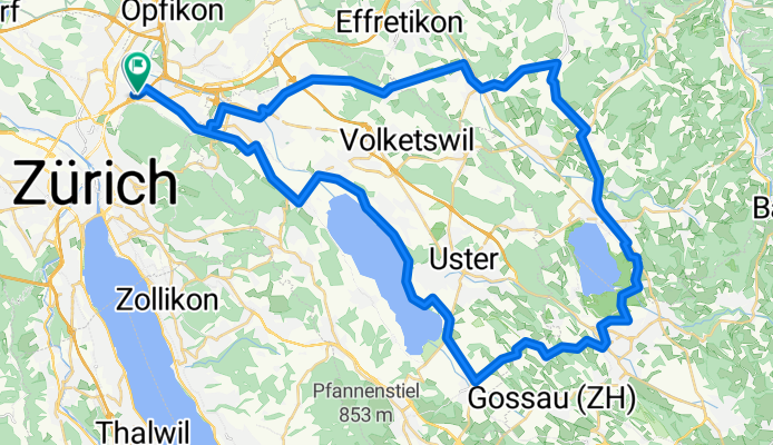
60km - ZH Nord - Pfäffikersee - Greifensee
A cycling route starting in Zürich (Kreis 12) / Saatlen, Canton of Zurich, Switzerland.
Overview
About this route
Strecke geeignet für Rennrad. Mehrheitlich flach mit vereinzelten leichten Steigungen.
Vorsicht: Z.Zt. Rollsplit auf ca. 1-2 km eingangs Mönchaltorf. Hier ist eine Routenänderung empfohlen für alle denen der Carbon-Rennradrahmen am Herzen liegt.
- -:--
- Duration
- 58.8 km
- Distance
- 367 m
- Ascent
- 366 m
- Descent
- ---
- Avg. speed
- ---
- Max. altitude
Route quality
Waytypes & surfaces along the route
Waytypes
Road
16.5 km
(28 %)
Quiet road
15.9 km
(27 %)
Surfaces
Paved
55.2 km
(94 %)
Unpaved
0.6 km
(1 %)
Asphalt
55.2 km
(94 %)
Gravel
0.6 km
(1 %)
Undefined
2.9 km
(5 %)
Continue with Bikemap
Use, edit, or download this cycling route
You would like to ride 60km - ZH Nord - Pfäffikersee - Greifensee or customize it for your own trip? Here is what you can do with this Bikemap route:
Free features
- Save this route as favorite or in collections
- Copy & plan your own version of this route
- Sync your route with Garmin or Wahoo
Premium features
Free trial for 3 days, or one-time payment. More about Bikemap Premium.
- Navigate this route on iOS & Android
- Export a GPX / KML file of this route
- Create your custom printout (try it for free)
- Download this route for offline navigation
Discover more Premium features.
Get Bikemap PremiumFrom our community
Other popular routes starting in Zürich (Kreis 12) / Saatlen
 Breiter-Greifen
- Distance
- 46 km
- Ascent
- 184 m
- Descent
- 184 m
- Location
- Zürich (Kreis 12) / Saatlen, Canton of Zurich, Switzerland
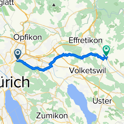 Hubenstrasse 24–26, Zürich nach Talgartenstrasse 15, Illnau
- Distance
- 15.6 km
- Ascent
- 1,118 m
- Descent
- 1,080 m
- Location
- Zürich (Kreis 12) / Saatlen, Canton of Zurich, Switzerland
 60km - ZH Nord - Pfäffikersee - Greifensee
- Distance
- 58.8 km
- Ascent
- 367 m
- Descent
- 366 m
- Location
- Zürich (Kreis 12) / Saatlen, Canton of Zurich, Switzerland
 home-hochwacht (860 müM)
- Distance
- 25.7 km
- Ascent
- 551 m
- Descent
- 135 m
- Location
- Zürich (Kreis 12) / Saatlen, Canton of Zurich, Switzerland
 1 mal dur Schwiiz
- Distance
- 331.7 km
- Ascent
- 4,184 m
- Descent
- 2,704 m
- Location
- Zürich (Kreis 12) / Saatlen, Canton of Zurich, Switzerland
 Beautiful lake cycle.....
- Distance
- 29.1 km
- Ascent
- 32 m
- Descent
- 31 m
- Location
- Zürich (Kreis 12) / Saatlen, Canton of Zurich, Switzerland
 Bachtel
- Distance
- 107.9 km
- Ascent
- 1,461 m
- Descent
- 1,464 m
- Location
- Zürich (Kreis 12) / Saatlen, Canton of Zurich, Switzerland
 zurUBS_viaHardbrücke
- Distance
- 7.4 km
- Ascent
- 80 m
- Descent
- 103 m
- Location
- Zürich (Kreis 12) / Saatlen, Canton of Zurich, Switzerland
Open it in the app