
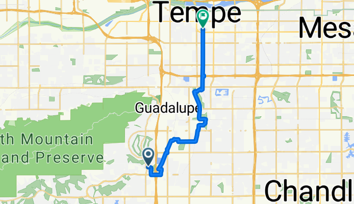
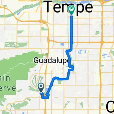
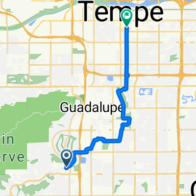
Ahwatukee to ASU
A cycling route starting in Guadalupe, Arizona, United States.
Overview
About this route
- 1 h 1 min
- Duration
- 17.2 km
- Distance
- 30 m
- Ascent
- 49 m
- Descent
- 16.9 km/h
- Avg. speed
- 379 m
- Max. altitude

Route quality
Waytypes & surfaces along the route
Waytypes
Cycleway
7.9 km
(46 %)
Road
4.1 km
(24 %)
Surfaces
Paved
16.5 km
(96 %)
Unpaved
0.7 km
(4 %)
Concrete
8.2 km
(48 %)
Asphalt
7.7 km
(45 %)
Continue with Bikemap
Use, edit, or download this cycling route
You would like to ride Ahwatukee to ASU or customize it for your own trip? Here is what you can do with this Bikemap route:
Free features
- Save this route as favorite or in collections
- Copy & plan your own version of this route
- Sync your route with Garmin or Wahoo
Premium features
Free trial for 3 days, or one-time payment. More about Bikemap Premium.
- Navigate this route on iOS & Android
- Export a GPX / KML file of this route
- Create your custom printout (try it for free)
- Download this route for offline navigation
Discover more Premium features.
Get Bikemap PremiumFrom our community
Other popular routes starting in Guadalupe
 Tour De Phoenix Canals
- Distance
- 146.2 km
- Ascent
- 117 m
- Descent
- 116 m
- Location
- Guadalupe, Arizona, United States
 Ahwatukee to ASU
- Distance
- 17.2 km
- Ascent
- 30 m
- Descent
- 49 m
- Location
- Guadalupe, Arizona, United States
 Mummy Mountain with Performance Chandler, AZ
- Distance
- 76.7 km
- Ascent
- 272 m
- Descent
- 270 m
- Location
- Guadalupe, Arizona, United States
 Tour de Dans
- Distance
- 54.1 km
- Ascent
- 180 m
- Descent
- 176 m
- Location
- Guadalupe, Arizona, United States
 From AHW to campus via Warner
- Distance
- 16.5 km
- Ascent
- 56 m
- Descent
- 75 m
- Location
- Guadalupe, Arizona, United States
 Ahwatukee Pecos Loop
- Distance
- 43.3 km
- Ascent
- 144 m
- Descent
- 143 m
- Location
- Guadalupe, Arizona, United States
 Francisco Park to South Mountain summit and back
- Distance
- 40.4 km
- Ascent
- 578 m
- Descent
- 580 m
- Location
- Guadalupe, Arizona, United States
 S 40th St, Phoenix to 17010 S 40th St, Phoenix
- Distance
- 19.4 km
- Ascent
- 78 m
- Descent
- 78 m
- Location
- Guadalupe, Arizona, United States
Open it in the app