
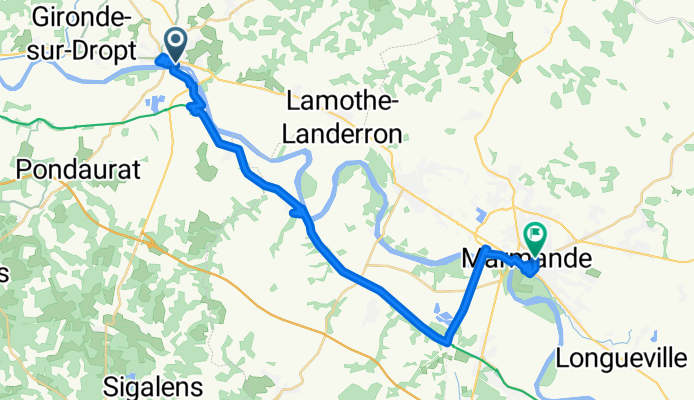
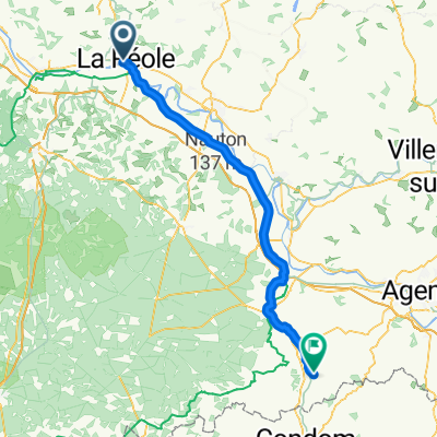
3.10.25 La Réole nach Marmande
A cycling route starting in La Réole, Nouvelle-Aquitaine, France.
Overview
About this route
Canal Lateral de la Garonne von La Réole nach Toulouse ist sehr gut befahrbar und meistens geteert. Mas d'Agenais nicht verpassen.
- 3 h 42 min
- Duration
- 37.5 km
- Distance
- 165 m
- Ascent
- 205 m
- Descent
- 10.2 km/h
- Avg. speed
- 81 m
- Max. altitude
Route photos


Route quality
Waytypes & surfaces along the route
Waytypes
Cycleway
19.5 km
(52 %)
Quiet road
9 km
(24 %)
Surfaces
Paved
30.8 km
(82 %)
Unpaved
0.8 km
(2 %)
Asphalt
27.8 km
(74 %)
Paved (undefined)
1.9 km
(5 %)
Continue with Bikemap
Use, edit, or download this cycling route
You would like to ride 3.10.25 La Réole nach Marmande or customize it for your own trip? Here is what you can do with this Bikemap route:
Free features
- Save this route as favorite or in collections
- Copy & plan your own version of this route
- Sync your route with Garmin or Wahoo
Premium features
Free trial for 3 days, or one-time payment. More about Bikemap Premium.
- Navigate this route on iOS & Android
- Export a GPX / KML file of this route
- Create your custom printout (try it for free)
- Download this route for offline navigation
Discover more Premium features.
Get Bikemap PremiumFrom our community
Other popular routes starting in La Réole
 La Réole - Nérac
- Distance
- 79.8 km
- Ascent
- 718 m
- Descent
- 601 m
- Location
- La Réole, Nouvelle-Aquitaine, France
 Impasse du Bois, Les Esseintes to Chemin des Fours, Haux
- Distance
- 57.6 km
- Ascent
- 591 m
- Descent
- 634 m
- Location
- La Réole, Nouvelle-Aquitaine, France
 3.10.25 La Réole nach Marmande
- Distance
- 37.5 km
- Ascent
- 165 m
- Descent
- 205 m
- Location
- La Réole, Nouvelle-Aquitaine, France
 Rue des Argentiers, La Réole à Rue des Argentiers, La Réole
- Distance
- 25.3 km
- Ascent
- 145 m
- Descent
- 155 m
- Location
- La Réole, Nouvelle-Aquitaine, France
 La Réole - La Sauve
- Distance
- 45 km
- Ascent
- 510 m
- Descent
- 446 m
- Location
- La Réole, Nouvelle-Aquitaine, France
 CB2014#5 - La Réole Le Grand Crohot - Cyclable
- Distance
- 138.6 km
- Ascent
- 254 m
- Descent
- 289 m
- Location
- La Réole, Nouvelle-Aquitaine, France
 La Réole - Montech
- Distance
- 145 km
- Ascent
- 542 m
- Descent
- 458 m
- Location
- La Réole, Nouvelle-Aquitaine, France
 From La Réole to Damazan
- Distance
- 49.7 km
- Ascent
- 361 m
- Descent
- 345 m
- Location
- La Réole, Nouvelle-Aquitaine, France
Open it in the app