
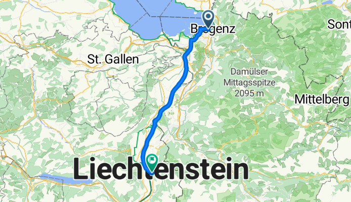
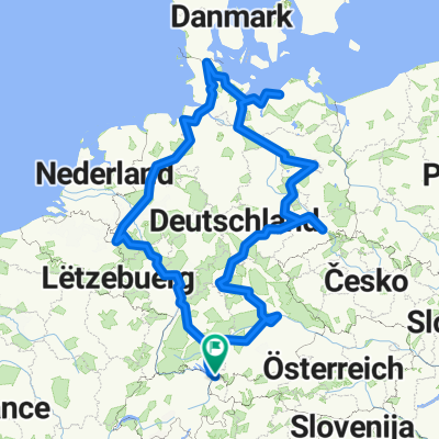
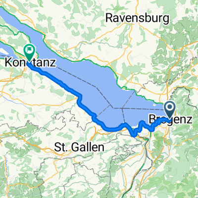
47.504, 9.732 nach 47.140, 9.523
A cycling route starting in Bregenz, Vorarlberg, Austria.
Overview
About this route
Embark on an exhilarating cycling adventure along this scenic route, perfect for those seeking a blend of challenge and beauty. Covering a distance of 52.3 km, this path offers a dynamic mix of terrain that keeps the ride engaging.
As you pedal, enjoy a gentle ascent of 106 meters, followed by a rewarding descent of 47 meters. The highlight of the journey is reaching a maximum elevation of 458 meters, providing breathtaking views and a sense of accomplishment.
Whether you're a seasoned cyclist or a casual rider, this route promises an enjoyable experience with its well-maintained surfaces. Embrace the thrill of the ride and the stunning landscapes that await you.
AI generated
- 3 h 15 min
- Duration
- 52.3 km
- Distance
- 107 m
- Ascent
- 47 m
- Descent
- 16.1 km/h
- Avg. speed
- 458 m
- Max. altitude

Route quality
Waytypes & surfaces along the route
Waytypes
Track
32.9 km
(63 %)
Cycleway
7.3 km
(14 %)
Surfaces
Paved
46.5 km
(89 %)
Unpaved
5.8 km
(11 %)
Asphalt
46 km
(88 %)
Gravel
5.2 km
(10 %)
Continue with Bikemap
Use, edit, or download this cycling route
You would like to ride 47.504, 9.732 nach 47.140, 9.523 or customize it for your own trip? Here is what you can do with this Bikemap route:
Free features
- Save this route as favorite or in collections
- Copy & plan your own version of this route
- Sync your route with Garmin or Wahoo
Premium features
Free trial for 3 days, or one-time payment. More about Bikemap Premium.
- Navigate this route on iOS & Android
- Export a GPX / KML file of this route
- Create your custom printout (try it for free)
- Download this route for offline navigation
Discover more Premium features.
Get Bikemap PremiumFrom our community
Other popular routes starting in Bregenz
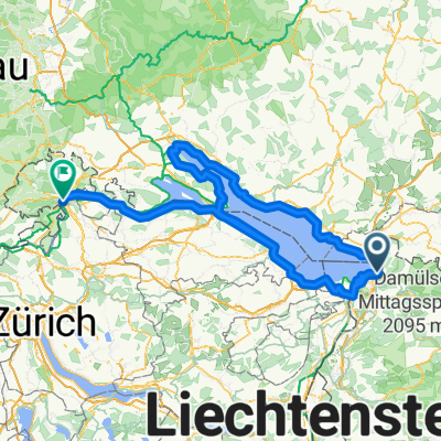 Bodensee Rundfahrt
- Distance
- 298.9 km
- Ascent
- 1,894 m
- Descent
- 1,925 m
- Location
- Bregenz, Vorarlberg, Austria
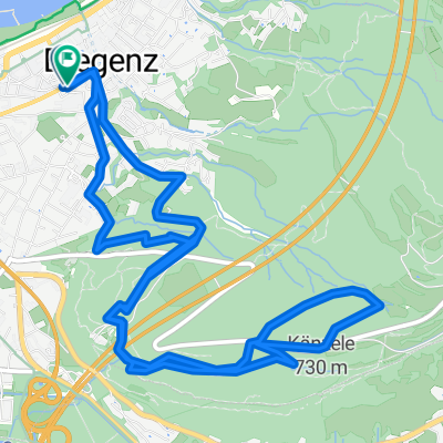 Sankt-Anna-Straße to Römerstraße
- Distance
- 9.2 km
- Ascent
- 362 m
- Descent
- 444 m
- Location
- Bregenz, Vorarlberg, Austria
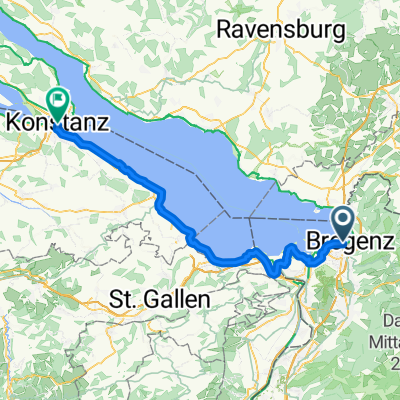 Von Bregenz bis Konstanz
- Distance
- 65.7 km
- Ascent
- 187 m
- Descent
- 185 m
- Location
- Bregenz, Vorarlberg, Austria
 Von Konstanz bis Bregenz
- Distance
- 3,647.8 km
- Ascent
- 20,464 m
- Descent
- 20,467 m
- Location
- Bregenz, Vorarlberg, Austria
 Bregenz - Uttwil
- Distance
- 51.8 km
- Ascent
- 144 m
- Descent
- 143 m
- Location
- Bregenz, Vorarlberg, Austria
 From Bregenz to Romanshorn
- Distance
- 45.1 km
- Ascent
- 139 m
- Descent
- 142 m
- Location
- Bregenz, Vorarlberg, Austria
 Brégence - Uttwil
- Distance
- 69 km
- Ascent
- 197 m
- Descent
- 185 m
- Location
- Bregenz, Vorarlberg, Austria
 Albert-Bechtold-Weg nach Brückenstrasse
- Distance
- 72.3 km
- Ascent
- 194 m
- Descent
- 234 m
- Location
- Bregenz, Vorarlberg, Austria
Open it in the app