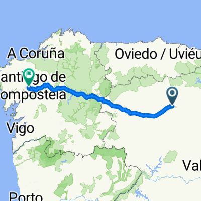
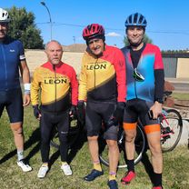
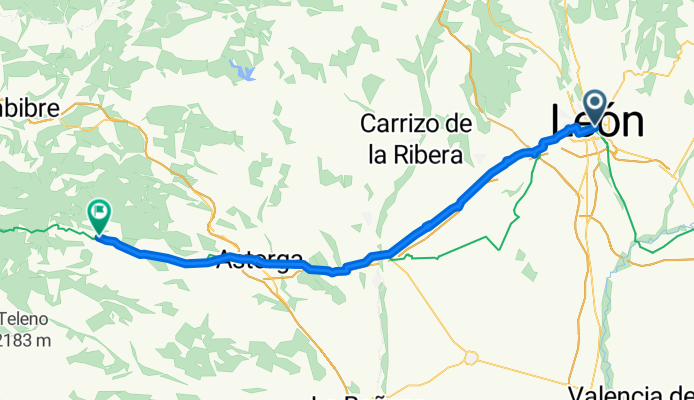
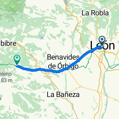
BHC D01 Le贸n - Astorga 60 km
A cycling route starting in Le贸n, Castille and Le贸n, Spain.
Overview
About this route
- 5 h 33 min
- Duration
- 74.2 km
- Distance
- 710 m
- Ascent
- 402 m
- Descent
- 13.4 km/h
- Avg. speed
- 1,150 m
- Max. altitude
Route quality
Waytypes & surfaces along the route
Waytypes
- Track - 28.2 km - (38 %) 
- Road - 14.1 km - (19 %) 
Surfaces
Paved
20 km
(27 %)
Unpaved
5.2 km
(7 %)
- Asphalt - 17.1 km - (23 %) 
- Gravel - 3 km - (4 %) 
Continue with Bikemap
Use, edit, or download this cycling route
You would like to ride BHC D01 Le贸n - Astorga 60 km or customize it for your own trip? Here is what you can do with this Bikemap route:
Free features
- Save this route as favorite or in collections
- Copy & plan your own version of this route
- Sync your route with Garmin or Wahoo
Premium features
Free trial for 3 days, or one-time payment. More about Bikemap Premium.
- Navigate this route on iOS & Android
- Export a GPX / KML file of this route
- Create your custom printout (try it for free)
- Download this route for offline navigation
Discover more Premium features.
Get Bikemap PremiumFrom our community
Other popular routes starting in Le贸n
 76 km. Le贸n, Lorenzana,La Pola de Gordon, y volver. 76 km. Le贸n, Lorenzana,La Pola de Gordon, y volver.- Distance
- 75.5 km
- Ascent
- 624 m
- Descent
- 671 m
- Location
- Le贸n, Castille and Le贸n, Spain
 
 LEON-S.ANDRES-MONTEJOS-CARRIZO-RIOFRIO-PALAZUELO-BENAVIDES-STA.MARINA REY-VILLADANGOS-LA LEON-S.ANDRES-MONTEJOS-CARRIZO-RIOFRIO-PALAZUELO-BENAVIDES-STA.MARINA REY-VILLADANGOS-LA- Distance
- 77.4 km
- Ascent
- 400 m
- Descent
- 405 m
- Location
- Le贸n, Castille and Le贸n, Spain
 
 74 km. la Sobarriba, rivera del Porma y Torio 74 km. la Sobarriba, rivera del Porma y Torio- Distance
- 74.4 km
- Ascent
- 543 m
- Descent
- 587 m
- Location
- Le贸n, Castille and Le贸n, Spain
 
 70 km. ruta de Valdesogo, Mansilla 70 km. ruta de Valdesogo, Mansilla- Distance
- 70.9 km
- Ascent
- 384 m
- Descent
- 427 m
- Location
- Le贸n, Castille and Le贸n, Spain
 
 74 km. ruta de las Oma帽as 74 km. ruta de las Oma帽as- Distance
- 74.4 km
- Ascent
- 632 m
- Descent
- 694 m
- Location
- Le贸n, Castille and Le贸n, Spain
 
 72 km. 72 km.- Distance
- 72.6 km
- Ascent
- 352 m
- Descent
- 399 m
- Location
- Le贸n, Castille and Le贸n, Spain
 
 BHC D01 Le贸n - Astorga 60 km BHC D01 Le贸n - Astorga 60 km- Distance
- 74.2 km
- Ascent
- 710 m
- Descent
- 402 m
- Location
- Le贸n, Castille and Le贸n, Spain
 
 PTE.CASTRO-MANSILLA-STAS. MARTAS-GUSENDOS-CORBILLOS-PALANQUINOS-VEGA DE INFANZONES PTE.CASTRO-MANSILLA-STAS. MARTAS-GUSENDOS-CORBILLOS-PALANQUINOS-VEGA DE INFANZONES- Distance
- 64.4 km
- Ascent
- 210 m
- Descent
- 220 m
- Location
- Le贸n, Castille and Le贸n, Spain
 
Open it in the app


