
송천동2가, 전주시에서 송천동2가, 전주시까지
A cycling route starting in Wanju, Jeollabuk-do, South Korea.
Overview
About this route
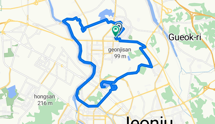
Welcome to your 23.4 km cycling adventure! This route offers a delightful mix of gentle climbs and smooth descents, perfect for all skill levels. Starting your journey, you'll ascend 96 meters to reach a peak elevation of 55 meters. The terrain is mostly paved, ensuring a smooth ride, with a gentle descent of 87 meters after your climb. Enjoy the scenic views and the challenge of this well-balanced ride.
- 2 h 14 min
- Duration
- 23.4 km
- Distance
- 97 m
- Ascent
- 87 m
- Descent
- 10.4 km/h
- Avg. speed
- 55 m
- Max. altitude
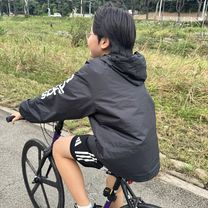
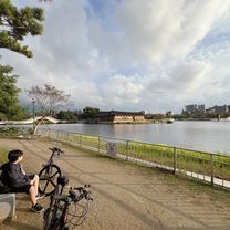
Route photos


Continue with Bikemap
Use, edit, or download this cycling route
You would like to ride 송천동2가, 전주시에서 송천동2가, 전주시까지 or customize it for your own trip? Here is what you can do with this Bikemap route:
Free features
- Save this route as favorite or in collections
- Copy & plan your own version of this route
- Sync your route with Garmin or Wahoo
Premium features
Free trial for 3 days, or one-time payment. More about Bikemap Premium.
- Navigate this route on iOS & Android
- Export a GPX / KML file of this route
- Create your custom printout (try it for free)
- Download this route for offline navigation
Discover more Premium features.
Get Bikemap PremiumFrom our community
Other popular routes starting in Wanju
 반월동 1233, 전주시 to 반월동 1232, 전주시
- Distance
- 54.4 km
- Ascent
- 209 m
- Descent
- 208 m
- Location
- Wanju, Jeollabuk-do, South Korea
 Easy ride
- Distance
- 33.6 km
- Ascent
- 261 m
- Descent
- 145 m
- Location
- Wanju, Jeollabuk-do, South Korea
 17-2 17-2 ~ 12-1 12-1
- Distance
- 19.4 km
- Ascent
- 156 m
- Descent
- 166 m
- Location
- Wanju, Jeollabuk-do, South Korea
 송천동2가, 전주시에서 송천동2가, 전주시까지
- Distance
- 28.4 km
- Ascent
- 140 m
- Descent
- 142 m
- Location
- Wanju, Jeollabuk-do, South Korea
 전주 송천동~삼봉 지구
- Distance
- 13 km
- Ascent
- 111 m
- Descent
- 116 m
- Location
- Wanju, Jeollabuk-do, South Korea
 전주-정읍-내장사-추령-단풍로-백양사-담양-순창-비홍치-남원 136km
- Distance
- 136.3 km
- Ascent
- 816 m
- Descent
- 745 m
- Location
- Wanju, Jeollabuk-do, South Korea
 전주-정읍역 I
- Distance
- 71.6 km
- Ascent
- 441 m
- Descent
- 443 m
- Location
- Wanju, Jeollabuk-do, South Korea
 송천동2가, 전주시에서 송천동2가, 전주시까지
- Distance
- 23.4 km
- Ascent
- 97 m
- Descent
- 87 m
- Location
- Wanju, Jeollabuk-do, South Korea
Open it in the app