
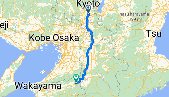
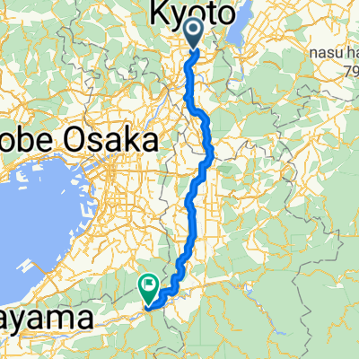
Kyoto - Tawaramoto
A cycling route starting in Kyoto, Kyoto, Japan.
Overview
About this route
- 6 h 8 min
- Duration
- 104.3 km
- Distance
- 867 m
- Ascent
- 767 m
- Descent
- 17 km/h
- Avg. speed
- 353 m
- Max. altitude
Route quality
Waytypes & surfaces along the route
Waytypes
Cycleway
51.1 km
(49 %)
Quiet road
42.7 km
(41 %)
Surfaces
Paved
19.8 km
(19 %)
Paved (undefined)
11.5 km
(11 %)
Asphalt
8.3 km
(8 %)
Undefined
84.4 km
(81 %)
Continue with Bikemap
Use, edit, or download this cycling route
You would like to ride Kyoto - Tawaramoto or customize it for your own trip? Here is what you can do with this Bikemap route:
Free features
- Save this route as favorite or in collections
- Copy & plan your own version of this route
- Split it into stages to create a multi-day tour
- Sync your route with Garmin or Wahoo
Premium features
Free trial for 3 days, or one-time payment. More about Bikemap Premium.
- Navigate this route on iOS & Android
- Export a GPX / KML file of this route
- Create your custom printout (try it for free)
- Download this route for offline navigation
Discover more Premium features.
Get Bikemap PremiumFrom our community
Other popular routes starting in Kyoto
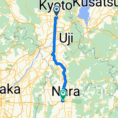 kyoto to nara
- Distance
- 44.6 km
- Ascent
- 121 m
- Descent
- 103 m
- Location
- Kyoto, Kyoto, Japan
 Kyoto-Nara-Osaka
- Distance
- 76.9 km
- Ascent
- 570 m
- Descent
- 596 m
- Location
- Kyoto, Kyoto, Japan
 Kioto - Kōbe
- Distance
- 84.6 km
- Ascent
- 306 m
- Descent
- 330 m
- Location
- Kyoto, Kyoto, Japan
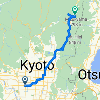
 東塩小路町, 京都市へ御陵町, 大津市
- Distance
- 46.6 km
- Ascent
- 505 m
- Descent
- 451 m
- Location
- Kyoto, Kyoto, Japan
 White Boddha
- Distance
- 21.1 km
- Ascent
- 61 m
- Descent
- 80 m
- Location
- Kyoto, Kyoto, Japan
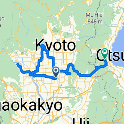
 Nishikyogoku-Otsu
- Distance
- 25.5 km
- Ascent
- 260 m
- Descent
- 205 m
- Location
- Kyoto, Kyoto, Japan
 洛北賞楓路線
- Distance
- 25 km
- Ascent
- 320 m
- Descent
- 77 m
- Location
- Kyoto, Kyoto, Japan
 Kyoto - Tawaramoto
- Distance
- 104.3 km
- Ascent
- 867 m
- Descent
- 767 m
- Location
- Kyoto, Kyoto, Japan
Open it in the app