
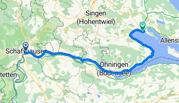
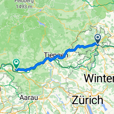
Deutschland2027 E1
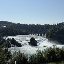
A cycling route starting in Schaffhausen, Canton of Schaffhausen, Switzerland.
Overview
About this route
- 2 h 43 min
- Duration
- 46 km
- Distance
- 336 m
- Ascent
- 340 m
- Descent
- 16.9 km/h
- Avg. speed
- 459 m
- Max. altitude

Route quality
Waytypes & surfaces along the route
Waytypes
Path
13.8 km
(30 %)
Quiet road
12.9 km
(28 %)
Surfaces
Paved
36.8 km
(80 %)
Unpaved
8.7 km
(19 %)
Asphalt
36.8 km
(80 %)
Gravel
8.3 km
(18 %)
Continue with Bikemap
Use, edit, or download this cycling route
You would like to ride Deutschland2027 E1 or customize it for your own trip? Here is what you can do with this Bikemap route:
Free features
- Save this route as favorite or in collections
- Copy & plan your own version of this route
- Sync your route with Garmin or Wahoo
Premium features
Free trial for 3 days, or one-time payment. More about Bikemap Premium.
- Navigate this route on iOS & Android
- Export a GPX / KML file of this route
- Create your custom printout (try it for free)
- Download this route for offline navigation
Discover more Premium features.
Get Bikemap PremiumFrom our community
Other popular routes starting in Schaffhausen
 Deutschland2027 E1
- Distance
- 46 km
- Ascent
- 336 m
- Descent
- 340 m
- Location
- Schaffhausen, Canton of Schaffhausen, Switzerland
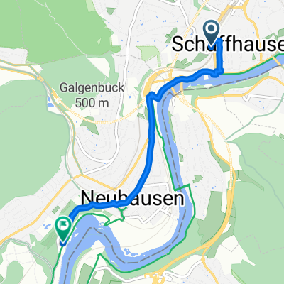 Von Schaffhausen bis Neuhausen am Rheinfall
- Distance
- 4.1 km
- Ascent
- 81 m
- Descent
- 123 m
- Location
- Schaffhausen, Canton of Schaffhausen, Switzerland
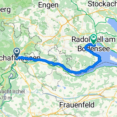
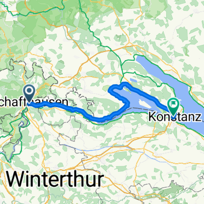 Radolfzell am Bodensee - Überlingen
- Distance
- 65.4 km
- Ascent
- 422 m
- Descent
- 423 m
- Location
- Schaffhausen, Canton of Schaffhausen, Switzerland
 Schaffhausen - Basel
- Distance
- 142.9 km
- Ascent
- 1,602 m
- Descent
- 1,778 m
- Location
- Schaffhausen, Canton of Schaffhausen, Switzerland
 Bahnhofstrasse, Schaffhausen to Nohlstrasse, Neuhausen am Rheinfall
- Distance
- 4.5 km
- Ascent
- 83 m
- Descent
- 99 m
- Location
- Schaffhausen, Canton of Schaffhausen, Switzerland
 Tag 11 : Steigstrasse, Schaffhausen nach Weihermatten, Bad Säckingen
- Distance
- 69.5 km
- Ascent
- 477 m
- Descent
- 621 m
- Location
- Schaffhausen, Canton of Schaffhausen, Switzerland
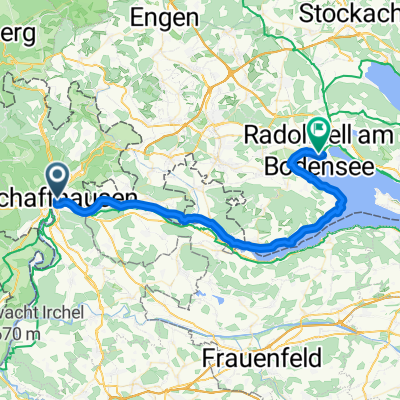
 Von Schaffhausen bis Radolfzell am Bodensee
- Distance
- 45.8 km
- Ascent
- 376 m
- Descent
- 382 m
- Location
- Schaffhausen, Canton of Schaffhausen, Switzerland
 Steigstrasse, Schaffhausen nach Bahnhofstraße, Villingen-Schwenningen
- Distance
- 51.3 km
- Ascent
- 897 m
- Descent
- 643 m
- Location
- Schaffhausen, Canton of Schaffhausen, Switzerland
Open it in the app