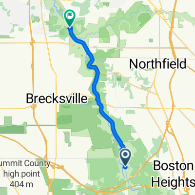
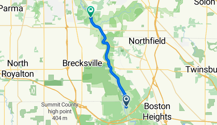
Recorded via Apple Watch on Oct 05 at 16:32
A cycling route starting in Peninsula, Ohio, United States.
Overview
About this route
- 44 min
 - Duration
 - 13.8 km
 - Distance
 - 7 m
 - Ascent
 - 22 m
 - Descent
 - 18.8 km/h
 - Avg. speed
 - 206 m
 - Max. altitude
 
Route quality
Waytypes & surfaces along the route
Waytypes
Cycleway
13.8 km
(100 %)
Surfaces
Paved
0.8 km
(6 %)
Unpaved
4 km
(29 %)
Gravel
4 km
(29 %)
Wood
0.8 km
(6 %)
Undefined
9 km
(65 %)
Continue with Bikemap
Use, edit, or download this cycling route
You would like to ride Recorded via Apple Watch on Oct 05 at 16:32 or customize it for your own trip? Here is what you can do with this Bikemap route:
Free features
- Save this route as favorite or in collections
 - Copy & plan your own version of this route
 - Sync your route with Garmin or Wahoo
 
Premium features
Free trial for 3 days, or one-time payment. More about Bikemap Premium.
- Navigate this route on iOS & Android
 - Export a GPX / KML file of this route
 - Create your custom printout (try it for free)
 - Download this route for offline navigation
 
Discover more Premium features.
Get Bikemap PremiumFrom our community
Other popular routes starting in Peninsula
Moderate route in Peninsula- Distance
 - 63.8 km
 - Ascent
 - 362 m
 - Descent
 - 362 m
 - Location
 - Peninsula, Ohio, United States
 
Recorded via Apple Watch on Oct 05 at 16:32- Distance
 - 13.8 km
 - Ascent
 - 7 m
 - Descent
 - 22 m
 - Location
 - Peninsula, Ohio, United States
 
Bronson St, Peninsula to N Washington St, Millersburg- Distance
 - 129.3 km
 - Ascent
 - 770 m
 - Descent
 - 760 m
 - Location
 - Peninsula, Ohio, United States
 
19 mile Lock 29/Stine+Truxell- Distance
 - 29.9 km
 - Ascent
 - 281 m
 - Descent
 - 276 m
 - Location
 - Peninsula, Ohio, United States
 
Pine Grove Trail, Peninsula to 405 Kendall Park Rd, Peninsula- Distance
 - 0.9 km
 - Ascent
 - 72 m
 - Descent
 - 53 m
 - Location
 - Peninsula, Ohio, United States
 
50-MILE 303/RIVERSIDE LOOP- Distance
 - 49.8 km
 - Ascent
 - 351 m
 - Descent
 - 350 m
 - Location
 - Peninsula, Ohio, United States
 
48K TWO-HILL LOOP- Distance
 - 47.9 km
 - Ascent
 - 297 m
 - Descent
 - 292 m
 - Location
 - Peninsula, Ohio, United States
 
Canal Exploration Center and Back- Distance
 - 19.6 km
 - Ascent
 - 92 m
 - Descent
 - 116 m
 - Location
 - Peninsula, Ohio, United States
 
Open it in the app

