
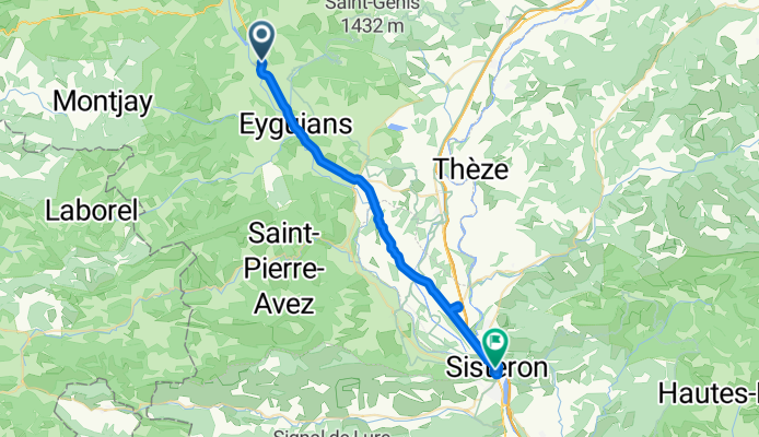
Montrond to Sisteron
A cycling route starting in Serres, Provence-Alpes-Côte d'Azur Region, France.
Overview
About this route
This was a ride on all arterial roads, most of which had too much traffic and too little road shoulder. As a result, we do not recommend this ride...unless you desire to get to Sisteron as quickly as possible.
The traffic did taper off after Laragne-Montéglin. It of course got heavier again as we neared Sisteron after our stop at a Lidl to keep us from starving.
In any case, it would be better to look for small roads that parallel as much as possible these arterial roads.
- 2 h 44 min
- Duration
- 30.9 km
- Distance
- 190 m
- Ascent
- 318 m
- Descent
- 11.3 km/h
- Avg. speed
- 631 m
- Max. altitude

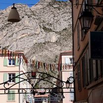
Route photos


Route quality
Waytypes & surfaces along the route
Waytypes
Quiet road
2.8 km
(9 %)
Access road
0.9 km
(3 %)
Undefined
27.2 km
(88 %)
Surfaces
Paved
28.8 km
(93 %)
Asphalt
28.8 km
(93 %)
Undefined
2.2 km
(7 %)
Continue with Bikemap
Use, edit, or download this cycling route
You would like to ride Montrond to Sisteron or customize it for your own trip? Here is what you can do with this Bikemap route:
Free features
- Save this route as favorite or in collections
- Copy & plan your own version of this route
- Sync your route with Garmin or Wahoo
Premium features
Free trial for 3 days, or one-time payment. More about Bikemap Premium.
- Navigate this route on iOS & Android
- Export a GPX / KML file of this route
- Create your custom printout (try it for free)
- Download this route for offline navigation
Discover more Premium features.
Get Bikemap PremiumFrom our community
Other popular routes starting in Serres
 Tour 5 Establet
- Distance
- 75.7 km
- Ascent
- 1,443 m
- Descent
- 1,443 m
- Location
- Serres, Provence-Alpes-Côte d'Azur Region, France
 VERSION FINALE SERRES GAP CLONED FROM ROUTE 2095415
- Distance
- 67.6 km
- Ascent
- 2,147 m
- Descent
- 2,065 m
- Location
- Serres, Provence-Alpes-Côte d'Azur Region, France
 Cheylard-Carabès-Aron-Praux-Rossas
- Distance
- 60.8 km
- Ascent
- 1,779 m
- Descent
- 1,779 m
- Location
- Serres, Provence-Alpes-Côte d'Azur Region, France
 Montrond to Sisteron
- Distance
- 30.9 km
- Ascent
- 190 m
- Descent
- 318 m
- Location
- Serres, Provence-Alpes-Côte d'Azur Region, France
 Tour 7 Valdrome
- Distance
- 69.5 km
- Ascent
- 1,246 m
- Descent
- 1,137 m
- Location
- Serres, Provence-Alpes-Côte d'Azur Region, France
 Tour 6 Montbrand
- Distance
- 64.2 km
- Ascent
- 693 m
- Descent
- 685 m
- Location
- Serres, Provence-Alpes-Côte d'Azur Region, France
 Cheylard-Charro-Carabes-Cabre-Pilhon-Leches-Guitar-Luc
- Distance
- 42.2 km
- Ascent
- 1,160 m
- Descent
- 1,580 m
- Location
- Serres, Provence-Alpes-Côte d'Azur Region, France
 JOUR 6
- Distance
- 71.8 km
- Ascent
- 1,361 m
- Descent
- 1,156 m
- Location
- Serres, Provence-Alpes-Côte d'Azur Region, France
Open it in the app