
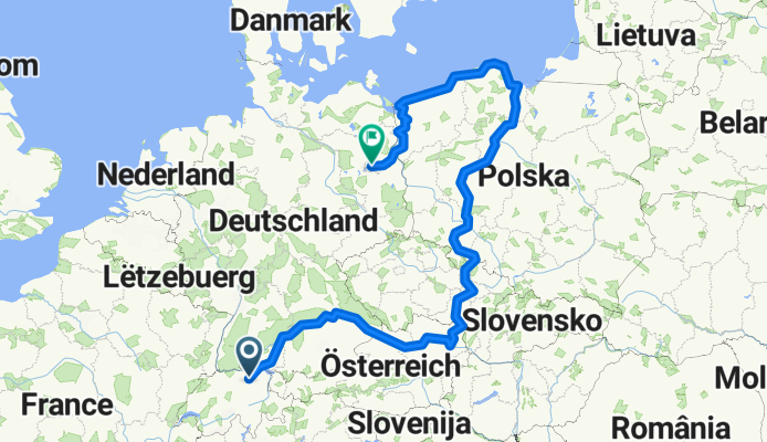
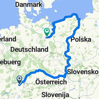
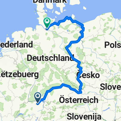
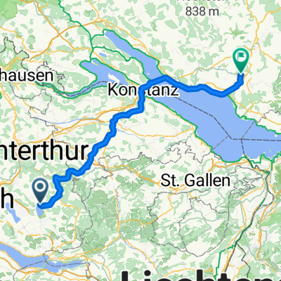
Von Pfäffikon bis Berlin
A cycling route starting in Pfäffikon / Pfäffikon (Dorfkern), Canton of Zurich, Switzerland.
Overview
About this route
- 166 h 23 min
- Duration
- 2,780.2 km
- Distance
- 15,763 m
- Ascent
- 16,266 m
- Descent
- 16.7 km/h
- Avg. speed
- 949 m
- Max. altitude

Route quality
Waytypes & surfaces along the route
Waytypes
Quiet road
695 km
(25 %)
Cycleway
611.6 km
(22 %)
Surfaces
Paved
2,057.3 km
(74 %)
Unpaved
278 km
(10 %)
Asphalt
1,918.3 km
(69 %)
Gravel
166.8 km
(6 %)
Continue with Bikemap
Use, edit, or download this cycling route
You would like to ride Von Pfäffikon bis Berlin or customize it for your own trip? Here is what you can do with this Bikemap route:
Free features
- Save this route as favorite or in collections
- Copy & plan your own version of this route
- Split it into stages to create a multi-day tour
- Sync your route with Garmin or Wahoo
Premium features
Free trial for 3 days, or one-time payment. More about Bikemap Premium.
- Navigate this route on iOS & Android
- Export a GPX / KML file of this route
- Create your custom printout (try it for free)
- Download this route for offline navigation
Discover more Premium features.
Get Bikemap PremiumFrom our community
Other popular routes starting in Pfäffikon / Pfäffikon (Dorfkern)
 Von Pfäffikon bis Berlin
- Distance
- 2,780.2 km
- Ascent
- 15,763 m
- Descent
- 16,266 m
- Location
- Pfäffikon / Pfäffikon (Dorfkern), Canton of Zurich, Switzerland
 Von Pfäffikon bis Hamburg
- Distance
- 2,280.5 km
- Ascent
- 14,693 m
- Descent
- 15,234 m
- Location
- Pfäffikon / Pfäffikon (Dorfkern), Canton of Zurich, Switzerland
 Pfäffikersee-Greifensee
- Distance
- 15.4 km
- Ascent
- 54 m
- Descent
- 155 m
- Location
- Pfäffikon / Pfäffikon (Dorfkern), Canton of Zurich, Switzerland
 Teil 1: Von Pfäffikon bis Meckenbeuren
- Distance
- 99 km
- Ascent
- 842 m
- Descent
- 977 m
- Location
- Pfäffikon / Pfäffikon (Dorfkern), Canton of Zurich, Switzerland
 leotwo. Pfäffikon, Saland, Turbenthal, Wildberg, Pfäffikon
- Distance
- 25.1 km
- Ascent
- 355 m
- Descent
- 296 m
- Location
- Pfäffikon / Pfäffikon (Dorfkern), Canton of Zurich, Switzerland
 Pfäffikon-Wald-Pfäffikon
- Distance
- 47.1 km
- Ascent
- 693 m
- Descent
- 678 m
- Location
- Pfäffikon / Pfäffikon (Dorfkern), Canton of Zurich, Switzerland
 Egger Route Extended
- Distance
- 70.4 km
- Ascent
- 599 m
- Descent
- 599 m
- Location
- Pfäffikon / Pfäffikon (Dorfkern), Canton of Zurich, Switzerland
 Pfäffikon Rund um Zürichsee
- Distance
- 76.9 km
- Ascent
- 335 m
- Descent
- 408 m
- Location
- Pfäffikon / Pfäffikon (Dorfkern), Canton of Zurich, Switzerland
Open it in the app