
majoreczka
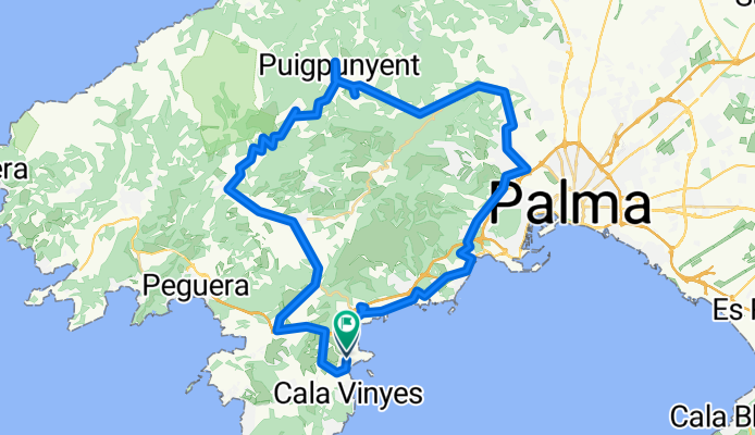
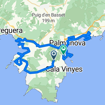
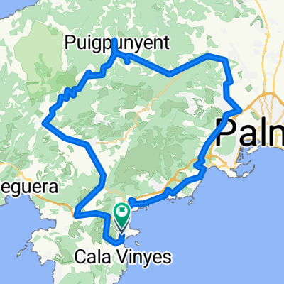
A cycling route starting in Magaluf, Balearic Islands, Spain.
Overview
About this route
- 5 h 45 min
- Duration
- 62.2 km
- Distance
- 1,097 m
- Ascent
- 1,145 m
- Descent
- 10.8 km/h
- Avg. speed
- 435 m
- Max. altitude

Route quality
Waytypes & surfaces along the route
Waytypes
Road
28.6 km
(46 %)
Cycleway
13.7 km
(22 %)
Surfaces
Paved
58.5 km
(94 %)
Asphalt
49.8 km
(80 %)
Concrete
8.7 km
(14 %)
Undefined
3.7 km
(6 %)
Continue with Bikemap
Use, edit, or download this cycling route
You would like to ride majoreczka or customize it for your own trip? Here is what you can do with this Bikemap route:
Free features
- Save this route as favorite or in collections
- Copy & plan your own version of this route
- Sync your route with Garmin or Wahoo
Premium features
Free trial for 3 days, or one-time payment. More about Bikemap Premium.
- Navigate this route on iOS & Android
- Export a GPX / KML file of this route
- Create your custom printout (try it for free)
- Download this route for offline navigation
Discover more Premium features.
Get Bikemap PremiumFrom our community
Other popular routes starting in Magaluf
 Villa Carmen - Son Font - Coll de sa Creu
- Distance
- 58.3 km
- Ascent
- 993 m
- Descent
- 993 m
- Location
- Magaluf, Balearic Islands, Spain
 Mallorca: Magaluf-cap de cala Figuera-el Toro-Santa Ponça-Peguera-es Capdellà-Magaluf
- Distance
- 48 km
- Ascent
- 467 m
- Descent
- 468 m
- Location
- Magaluf, Balearic Islands, Spain
 Mallorca: sa Porrassa-cales de ponent de la badia de Palma-cap de cala Figuera-cala Refaubetx-el Toro-sa Porrassa
- Distance
- 32.4 km
- Ascent
- 379 m
- Descent
- 376 m
- Location
- Magaluf, Balearic Islands, Spain
 Mallorca a peu: ponent de la badia de Palma (1)
- Distance
- 8.7 km
- Ascent
- 146 m
- Descent
- 146 m
- Location
- Magaluf, Balearic Islands, Spain
 Mallorca: Magalug-far de cala Figuera-el Toro-Santa Ponça-Magaluf
- Distance
- 30.6 km
- Ascent
- 386 m
- Descent
- 387 m
- Location
- Magaluf, Balearic Islands, Spain
 Majorka
- Distance
- 47.1 km
- Ascent
- 717 m
- Descent
- 781 m
- Location
- Magaluf, Balearic Islands, Spain
 Mallorca: Son Bugadelles-es Capdellà-Andratx-s'Arracó-Sant Elm-Port d'Andratx-es Camp de Mar-Peguera-es Capdellà-Calvià-Son Bugadelles
- Distance
- 58.3 km
- Ascent
- 725 m
- Descent
- 726 m
- Location
- Magaluf, Balearic Islands, Spain
 majoreczka
- Distance
- 62.2 km
- Ascent
- 1,097 m
- Descent
- 1,145 m
- Location
- Magaluf, Balearic Islands, Spain
Open it in the app