
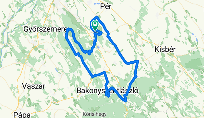
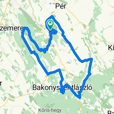
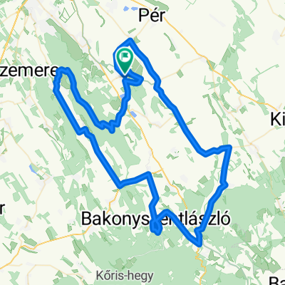
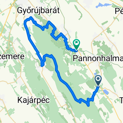
Pannonhalma ring hosszú
A cycling route starting in Pannonhalma, Győr-Moson-Sopron, Hungary.
Overview
About this route
Embark on a thrilling cycling adventure along this scenic route, where the journey is as rewarding as the destination. Covering a total distance of 102.4 km, this route offers a dynamic mix of climbs and descents, perfect for those looking to test their skills and enjoy the thrill of the ride.
You'll ascend to a peak elevation of 294 meters, providing breathtaking views along the way. The route ascends 648 meters before descending back down, adding a touch of excitement and challenge to your ride. With 650 meters of descent, the path offers smooth and exhilarating downhill stretches.
Whether you're a seasoned cyclist or a casual rider looking to explore new trails, this route promises an unforgettable experience filled with both physical and visual delights. So gear up, embrace the adventure, and let the wheels roll!
AI generated
- 3 h 26 min
- Duration
- 102.4 km
- Distance
- 648 m
- Ascent
- 651 m
- Descent
- 29.8 km/h
- Avg. speed
- 295 m
- Max. altitude
Route quality
Waytypes & surfaces along the route
Waytypes
Quiet road
21.5 km
(21 %)
Road
17.4 km
(17 %)
Surfaces
Paved
91.2 km
(89 %)
Asphalt
91.2 km
(89 %)
Undefined
11.3 km
(11 %)
Continue with Bikemap
Use, edit, or download this cycling route
You would like to ride Pannonhalma ring hosszú or customize it for your own trip? Here is what you can do with this Bikemap route:
Free features
- Save this route as favorite or in collections
- Copy & plan your own version of this route
- Split it into stages to create a multi-day tour
- Sync your route with Garmin or Wahoo
Premium features
Free trial for 3 days, or one-time payment. More about Bikemap Premium.
- Navigate this route on iOS & Android
- Export a GPX / KML file of this route
- Create your custom printout (try it for free)
- Download this route for offline navigation
Discover more Premium features.
Get Bikemap PremiumFrom our community
Other popular routes starting in Pannonhalma
 Pannonhalma ring hosszú
- Distance
- 102.3 km
- Ascent
- 648 m
- Descent
- 651 m
- Location
- Pannonhalma, Győr-Moson-Sopron, Hungary
 Pannonhalma ring hosszú
- Distance
- 102.4 km
- Ascent
- 648 m
- Descent
- 651 m
- Location
- Pannonhalma, Győr-Moson-Sopron, Hungary
 Laza karika
- Distance
- 72.1 km
- Ascent
- 245 m
- Descent
- 248 m
- Location
- Pannonhalma, Győr-Moson-Sopron, Hungary
 8224-es mellékút, Nyalka - Tihanyi Árpád út, Győr
- Distance
- 22.5 km
- Ascent
- 59 m
- Descent
- 147 m
- Location
- Pannonhalma, Győr-Moson-Sopron, Hungary
 Pannonhalma ring hosszú
- Distance
- 102.3 km
- Ascent
- 649 m
- Descent
- 652 m
- Location
- Pannonhalma, Győr-Moson-Sopron, Hungary
 73km_750m_PHalma-Csesznek-Zirc-Eplény
- Distance
- 73.3 km
- Ascent
- 680 m
- Descent
- 639 m
- Location
- Pannonhalma, Győr-Moson-Sopron, Hungary
 Route to Jegenye étterem
- Distance
- 41.6 km
- Ascent
- 632 m
- Descent
- 639 m
- Location
- Pannonhalma, Győr-Moson-Sopron, Hungary
 Május 1-Pannonhalma-Fenyőfő-Panonhalma
- Distance
- 79.3 km
- Ascent
- 465 m
- Descent
- 474 m
- Location
- Pannonhalma, Győr-Moson-Sopron, Hungary
Open it in the app