- 19.2 km
- 122 m
- 131 m
- Belmont, California, United States
Southview Ct, Belmont to Southview Ct, Belmont
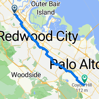
A cycling route starting in Belmont, California, United States.
Overview
About this route
Discover the thrill of the ride along this exhilarating 5.8 km cycling route! Begin your adventure at the starting point and weave through scenic landscapes. The route features an engaging mix of gentle climbs and exhilarating descents, with an ascent of 152 meters and a descent of 154 meters. Feel the rush as you reach a maximum elevation of 89 meters, offering stunning views along the way. This well-maintained path combines paved and unpaved sections, ensuring a smooth and enjoyable ride for cyclists of all levels. Embrace the challenge and experience the thrill of conquering this dynamic cycling journey!
AI generated
- 19 min
- Duration
- 5.8 km
- Distance
- 152 m
- Ascent
- 154 m
- Descent
- 17.9 km/h
- Avg. speed
- 90 m
- Max. altitude
created this 2 months ago
Route quality
Waytypes & surfaces along the route
Waytypes
Quiet road
4.3 km
(75 %)
Access road
0.5 km
(9 %)
Surfaces
Paved
5.5 km
(95 %)
Asphalt
5.2 km
(90 %)
Concrete
0.3 km
(5 %)
Undefined
0.3 km
(5 %)
Continue with Bikemap
Use, edit, or download this cycling route
You would like to ride Southview Ct, Belmont to Southview Ct, Belmont or customize it for your own trip? Here is what you can do with this Bikemap route:
Free features
- Save this route as favorite or in collections
- Copy & plan your own version of this route
- Sync your route with Garmin or Wahoo
Premium features
Free trial for 3 days, or one-time payment. More about Bikemap Premium.
- Navigate this route on iOS & Android
- Export a GPX / KML file of this route
- Create your custom printout (try it for free)
- Download this route for offline navigation
Discover more Premium features.
Get Bikemap PremiumFrom our community
Other popular routes starting in Belmont
- San Mateo, Belmont, Foster City, San Mateo
- Alameda through Cold Spring
- 19.1 km
- 332 m
- 333 m
- Belmont, California, United States
- Water Dog Loop v2 - Avoiding steepest part
- 8 km
- 425 m
- 425 m
- Belmont, California, United States
- TourDeCalifornia_2010Stage3_firstportion
- 106.1 km
- 1,510 m
- 1,500 m
- Belmont, California, United States
- Home To Work - My Scenic
- 20.7 km
- 35 m
- 28 m
- Belmont, California, United States
- Southview Ct, Belmont to Southview Ct, Belmont
- 5.8 km
- 152 m
- 154 m
- Belmont, California, United States
- home to work - direct
- 19.2 km
- 39 m
- 32 m
- Belmont, California, United States
- First ride on the Alight
- 15.6 km
- 6 m
- 6 m
- Belmont, California, United States
Open it in the app


