
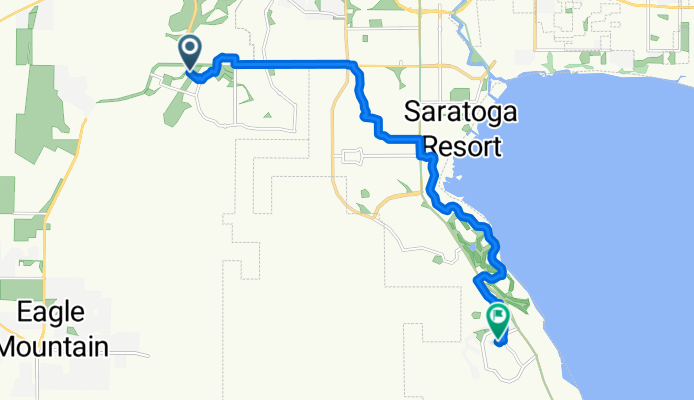
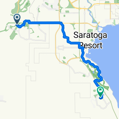
E Pony Express Pkwy, Eagle Mountain to S Red Pine Dr, Saratoga Springs
A cycling route starting in Eagle Mountain, Utah, United States.
Overview
About this route
- 54 min
- Duration
- 14.3 km
- Distance
- 86 m
- Ascent
- 119 m
- Descent
- 15.9 km/h
- Avg. speed
- 1,481 m
- Max. altitude
Route quality
Waytypes & surfaces along the route
Waytypes
Quiet road
7.6 km
(53 %)
Track
2.9 km
(20 %)
Surfaces
Paved
6.6 km
(46 %)
Asphalt
6.6 km
(46 %)
Undefined
7.7 km
(54 %)
Continue with Bikemap
Use, edit, or download this cycling route
You would like to ride E Pony Express Pkwy, Eagle Mountain to S Red Pine Dr, Saratoga Springs or customize it for your own trip? Here is what you can do with this Bikemap route:
Free features
- Save this route as favorite or in collections
- Copy & plan your own version of this route
- Sync your route with Garmin or Wahoo
Premium features
Free trial for 3 days, or one-time payment. More about Bikemap Premium.
- Navigate this route on iOS & Android
- Export a GPX / KML file of this route
- Create your custom printout (try it for free)
- Download this route for offline navigation
Discover more Premium features.
Get Bikemap PremiumFrom our community
Other popular routes starting in Eagle Mountain
 Nirvana, Back, Race and Coyote with Tread and Supersonic back
- Distance
- 21.2 km
- Ascent
- 337 m
- Descent
- 327 m
- Location
- Eagle Mountain, Utah, United States
 W 1600 N, Fairfield to 414 E Gilbert Peak Way, Eagle Mountain
- Distance
- 16.1 km
- Ascent
- 32 m
- Descent
- 19 m
- Location
- Eagle Mountain, Utah, United States
 Eagle Mountain to 7260 N Locust Ave, Eagle Mountain
- Distance
- 4.9 km
- Ascent
- 118 m
- Descent
- 116 m
- Location
- Eagle Mountain, Utah, United States
 E Pony Express Pkwy, Eagle Mountain to S Red Pine Dr, Saratoga Springs
- Distance
- 14.3 km
- Ascent
- 86 m
- Descent
- 119 m
- Location
- Eagle Mountain, Utah, United States
 2419 E Jim Bridger Dr, Eagle Mountain to 2419 E Jim Bridger Dr, Eagle Mountain
- Distance
- 12.4 km
- Ascent
- 109 m
- Descent
- 107 m
- Location
- Eagle Mountain, Utah, United States
 7260 N Locust Ave, Eagle Mountain to 2419 E Jim Bridger Dr, Eagle Mountain
- Distance
- 11.6 km
- Ascent
- 176 m
- Descent
- 215 m
- Location
- Eagle Mountain, Utah, United States
 7447 N Hidden Valley Pkwy, Eagle Mountain to 7447 N Hidden Valley Pkwy, Eagle Mountain
- Distance
- 3.8 km
- Ascent
- 61 m
- Descent
- 59 m
- Location
- Eagle Mountain, Utah, United States
 2419 E Jim Bridger Dr, Eagle Mountain to 2419 E Jim Bridger Dr, Eagle Mountain
- Distance
- 5.3 km
- Ascent
- 22 m
- Descent
- 22 m
- Location
- Eagle Mountain, Utah, United States
Open it in the app