
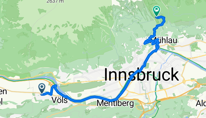
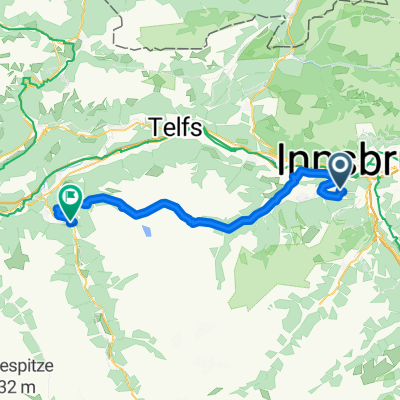
Maximilianstraße, Völs nach Rosnerweg, Innsbruck
A cycling route starting in Völs, Tyrol, Austria.
Overview
About this route
Discover the Scenic Route from Wolkensteinstraße 1C to Arzler Alm!
Embark on an exhilarating cycling adventure that spans 15.8 kilometers through picturesque landscapes. Starting at Wolkensteinstraße 1C in Völs, this route takes you on a journey to the serene Arzler Alm in Innsbruck, Tirol, Österreich.
Highlights:
- Elevation Highlights: Ascend a total of 663 meters, culminating at a maximum elevation of 1078 meters. Enjoy a gentle descent of 180 meters to reach your destination.
- Surface Variety: Experience a delightful mix of surfaces, with asphalt dominating 68.5% of the journey and shaggy patches adding texture and challenge.
- Way Types: The route features a harmonious blend of Radweg (54.7%), Forststraße (19.5%), Ruhige Straße (11.1%), and Pfad (10.2%), offering a diverse cycling experience.
- Bike Network: Navigate through a network that combines Regional paths (42.3%), International routes (12.3%), and some undefined trails (45.3%), ensuring a well-connected journey.
Whether you're a seasoned cyclist or a casual rider, this route promises an engaging and scenic ride, perfect for enjoying the natural beauty of the region. Safe travels and happy cycling!
AI generated
- 1 h 28 min
- Duration
- 15.8 km
- Distance
- 664 m
- Ascent
- 181 m
- Descent
- 10.7 km/h
- Avg. speed
- 1,078 m
- Max. altitude

Route quality
Waytypes & surfaces along the route
Waytypes
Cycleway
8.5 km
(54 %)
Track
3.2 km
(20 %)
Surfaces
Paved
10.7 km
(68 %)
Unpaved
3.5 km
(22 %)
Asphalt
10.6 km
(67 %)
Gravel
3 km
(19 %)
Continue with Bikemap
Use, edit, or download this cycling route
You would like to ride Maximilianstraße, Völs nach Rosnerweg, Innsbruck or customize it for your own trip? Here is what you can do with this Bikemap route:
Free features
- Save this route as favorite or in collections
- Copy & plan your own version of this route
- Sync your route with Garmin or Wahoo
Premium features
Free trial for 3 days, or one-time payment. More about Bikemap Premium.
- Navigate this route on iOS & Android
- Export a GPX / KML file of this route
- Create your custom printout (try it for free)
- Download this route for offline navigation
Discover more Premium features.
Get Bikemap PremiumFrom our community
Other popular routes starting in Völs
 Campingplatz Kranebitten - Höttinger Alm
- Distance
- 12.8 km
- Ascent
- 996 m
- Descent
- 122 m
- Location
- Völs, Tyrol, Austria
 Kühtai Sattel 2009
- Distance
- 55.3 km
- Ascent
- 1,805 m
- Descent
- 1,740 m
- Location
- Völs, Tyrol, Austria
 Innsbruck - Ried in Oberinntal
- Distance
- 91.4 km
- Ascent
- 364 m
- Descent
- 111 m
- Location
- Völs, Tyrol, Austria
 Innsbruck - Scuol
- Distance
- 138.5 km
- Ascent
- 1,050 m
- Descent
- 372 m
- Location
- Völs, Tyrol, Austria
 von Innsbruck nach Cavaion am Gardasee
- Distance
- 418.8 km
- Ascent
- 2,288 m
- Descent
- 2,648 m
- Location
- Völs, Tyrol, Austria
 test
test- Distance
- 5.4 km
- Ascent
- 436 m
- Descent
- 70 m
- Location
- Völs, Tyrol, Austria
 Inn túra 6.nap
- Distance
- 89.3 km
- Ascent
- 29 m
- Descent
- 119 m
- Location
- Völs, Tyrol, Austria
 Lanser Kopf
- Distance
- 26.6 km
- Ascent
- 387 m
- Descent
- 384 m
- Location
- Völs, Tyrol, Austria
Open it in the app