
Von Essen bis Hofheim am Taunus
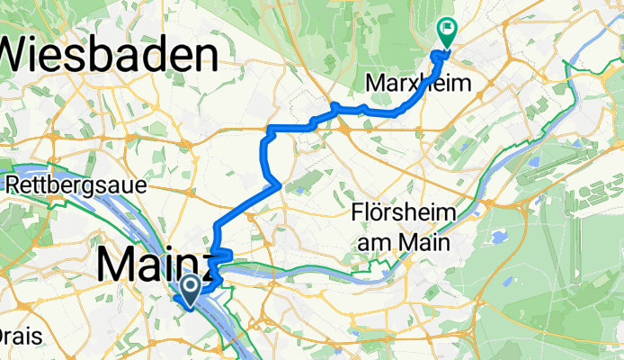
Bingen am Rhein - Hofheim am Taunus
A cycling route starting in Mainz, Rhineland-Palatinate, Germany.
Overview
About this route
- 1 h 18 min
- Duration
- 24.1 km
- Distance
- 140 m
- Ascent
- 125 m
- Descent
- 18.6 km/h
- Avg. speed
- 198 m
- Max. altitude

Part of
Von Essen bis Hofheim am Taunus
3 stages
Route quality
Waytypes & surfaces along the route
Waytypes
Track
8.7 km
(36 %)
Quiet road
5.1 km
(21 %)
Surfaces
Paved
22.9 km
(95 %)
Asphalt
16.9 km
(70 %)
Concrete
4.3 km
(18 %)
Continue with Bikemap
Use, edit, or download this cycling route
You would like to ride Bingen am Rhein - Hofheim am Taunus or customize it for your own trip? Here is what you can do with this Bikemap route:
Free features
- Save this route as favorite or in collections
- Copy & plan your own version of this route
- Sync your route with Garmin or Wahoo
Premium features
Free trial for 3 days, or one-time payment. More about Bikemap Premium.
- Navigate this route on iOS & Android
- Export a GPX / KML file of this route
- Create your custom printout (try it for free)
- Download this route for offline navigation
Discover more Premium features.
Get Bikemap PremiumFrom our community
Other popular routes starting in Mainz
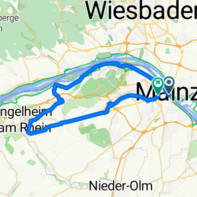 31_Mainz – Heidesheim – Ingelheim – Gonsenheim – Mainz
- Distance
- 40.5 km
- Ascent
- 227 m
- Descent
- 213 m
- Location
- Mainz, Rhineland-Palatinate, Germany
 mainz-rheinhessen-rheingau-mainz
- Distance
- 45.2 km
- Ascent
- 210 m
- Descent
- 210 m
- Location
- Mainz, Rhineland-Palatinate, Germany
 20190824 Schoppingroute
- Distance
- 15.7 km
- Ascent
- 72 m
- Descent
- 71 m
- Location
- Mainz, Rhineland-Palatinate, Germany
 MZ - Hohe Wurzel - Mainz
- Distance
- 42.3 km
- Ascent
- 609 m
- Descent
- 609 m
- Location
- Mainz, Rhineland-Palatinate, Germany
 Mainz Ingelheim-Nord Oestrich-winkel
- Distance
- 46.8 km
- Ascent
- 62 m
- Descent
- 60 m
- Location
- Mainz, Rhineland-Palatinate, Germany
 Kleiner Rundweg zwischen MzKastel und Wicker
- Distance
- 23.7 km
- Ascent
- 104 m
- Descent
- 87 m
- Location
- Mainz, Rhineland-Palatinate, Germany
 Gemütliche Route in Mainz
- Distance
- 20.3 km
- Ascent
- 144 m
- Descent
- 144 m
- Location
- Mainz, Rhineland-Palatinate, Germany
 ADFC 29.03.20
- Distance
- 49.6 km
- Ascent
- 170 m
- Descent
- 167 m
- Location
- Mainz, Rhineland-Palatinate, Germany
Open it in the app