
송천동2가, 전주시에서 송천동2가, 전주시까지
A cycling route starting in Wanju, Jeollabuk-do, South Korea.
Overview
About this route
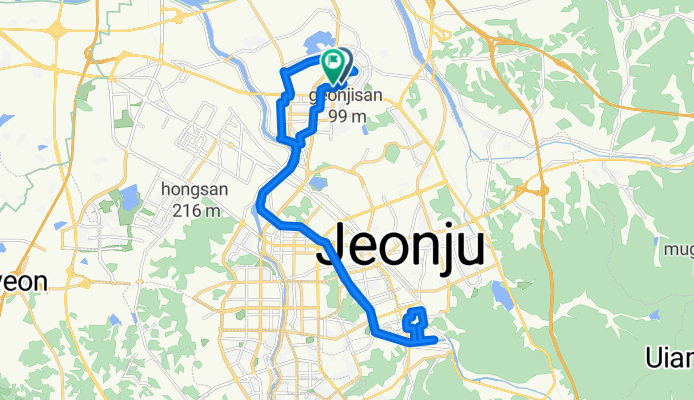
Embark on an exhilarating 28.4 km cycling adventure that promises both challenge and beauty. This route takes you through varied terrains, with an ascent of 139 meters and a descent of 142 meters, culminating in a maximum elevation of 51 meters. Experience the thrill of navigating through winding paths and scenic landscapes, offering a perfect blend of physical exertion and picturesque views. Whether you're a seasoned cyclist or a keen enthusiast, this journey offers a rewarding experience for all levels.
- 2 h 15 min
- Duration
- 28.4 km
- Distance
- 140 m
- Ascent
- 142 m
- Descent
- 12.6 km/h
- Avg. speed
- 52 m
- Max. altitude
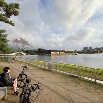
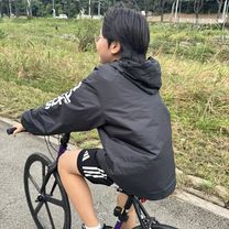
Route photos


Continue with Bikemap
Use, edit, or download this cycling route
You would like to ride 송천동2가, 전주시에서 송천동2가, 전주시까지 or customize it for your own trip? Here is what you can do with this Bikemap route:
Free features
- Save this route as favorite or in collections
- Copy & plan your own version of this route
- Sync your route with Garmin or Wahoo
Premium features
Free trial for 3 days, or one-time payment. More about Bikemap Premium.
- Navigate this route on iOS & Android
- Export a GPX / KML file of this route
- Create your custom printout (try it for free)
- Download this route for offline navigation
Discover more Premium features.
Get Bikemap PremiumFrom our community
Other popular routes starting in Wanju
 Easy ride
- Distance
- 33.6 km
- Ascent
- 261 m
- Descent
- 145 m
- Location
- Wanju, Jeollabuk-do, South Korea
 자전거퇴근
자전거퇴근- Distance
- 2.3 km
- Ascent
- 34 m
- Descent
- 55 m
- Location
- Wanju, Jeollabuk-do, South Korea
 송천동2가, 전주시에서 송천동2가, 전주시까지
- Distance
- 23.4 km
- Ascent
- 97 m
- Descent
- 87 m
- Location
- Wanju, Jeollabuk-do, South Korea
 전주-정읍-내장사-추령-단풍로-백양사-담양-순창-비홍치-남원 136km
- Distance
- 136.3 km
- Ascent
- 816 m
- Descent
- 745 m
- Location
- Wanju, Jeollabuk-do, South Korea
 반월동 1233, 전주시 to 반월동 1232, 전주시
- Distance
- 54.4 km
- Ascent
- 209 m
- Descent
- 208 m
- Location
- Wanju, Jeollabuk-do, South Korea
 jeonju-busan
- Distance
- 264.9 km
- Ascent
- 1,552 m
- Descent
- 1,414 m
- Location
- Wanju, Jeollabuk-do, South Korea
 송천동2가, 전주시에서 송천동2가, 전주시까지
- Distance
- 28.4 km
- Ascent
- 140 m
- Descent
- 142 m
- Location
- Wanju, Jeollabuk-do, South Korea
 전주-정읍-내장사-추령-단풍로-백양사-담양-순창-비홍치-남원 138km 1420m
- Distance
- 138.2 km
- Ascent
- 902 m
- Descent
- 831 m
- Location
- Wanju, Jeollabuk-do, South Korea
Open it in the app