
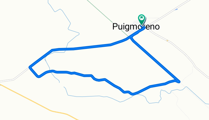
De Calle Mayor a Calle Mayor
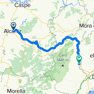
A cycling route starting in Alcañiz, Aragon, Spain.
Overview
About this route
- 31 min
- Duration
- 9.8 km
- Distance
- 41 m
- Ascent
- 92 m
- Descent
- 18.7 km/h
- Avg. speed
- 367 m
- Max. altitude
Continue with Bikemap
Use, edit, or download this cycling route
You would like to ride De Calle Mayor a Calle Mayor or customize it for your own trip? Here is what you can do with this Bikemap route:
Free features
- Save this route as favorite or in collections
- Copy & plan your own version of this route
- Sync your route with Garmin or Wahoo
Premium features
Free trial for 3 days, or one-time payment. More about Bikemap Premium.
- Navigate this route on iOS & Android
- Export a GPX / KML file of this route
- Create your custom printout (try it for free)
- Download this route for offline navigation
Discover more Premium features.
Get Bikemap PremiumFrom our community
Other popular routes starting in Alcañiz
 Ruta del Cabezo Negro
- Distance
- 40 km
- Ascent
- 371 m
- Descent
- 368 m
- Location
- Alcañiz, Aragon, Spain
 Alcañiz - Almuerzo en Valdeltormo
- Distance
- 55.9 km
- Ascent
- 529 m
- Descent
- 528 m
- Location
- Alcañiz, Aragon, Spain
 Vía Verde Alcañiz - Tortosa
- Distance
- 100.6 km
- Ascent
- 579 m
- Descent
- 899 m
- Location
- Alcañiz, Aragon, Spain
 Etapa Acabando en San Cristobal
- Distance
- 180.1 km
- Ascent
- 2,299 m
- Descent
- 1,233 m
- Location
- Alcañiz, Aragon, Spain
 Vall de Zafan
- Distance
- 93.9 km
- Ascent
- 1,966 m
- Descent
- 2,265 m
- Location
- Alcañiz, Aragon, Spain
 Alcañiz - Almuerzo en Calanda
- Distance
- 55.2 km
- Ascent
- 364 m
- Descent
- 363 m
- Location
- Alcañiz, Aragon, Spain
 Alcañiz - Almuerzo en La Codoñera
- Distance
- 58.6 km
- Ascent
- 465 m
- Descent
- 464 m
- Location
- Alcañiz, Aragon, Spain
 Alcañiz - Monreal
- Distance
- 141.7 km
- Ascent
- 1,646 m
- Descent
- 1,048 m
- Location
- Alcañiz, Aragon, Spain
Open it in the app