

Surrey League - Norwood Hill course
A cycling route starting in Reigate, England, United Kingdom.
Overview
About this route
Approx as Surrey League description is poor
<span style="font-family: 'Comic Sans MS'; color: #800080; font-size: small;">Norwood Hill</span> <span style="font-family: 'Comic Sans MS'; font-size: x-small;">
<font color="#800080">Location: 4 miles south east of Dorking</font>
<font color="#800080">Course Details: Proceed south along Charmans Lane/Clayhill Road/Broad Lane. Turn left (M) into Parkgate Road. Turn left (M) into Stanhill Road. Turn left (M) into Norwood Hill Road/Smallshill Road/ Tapners Road. Turn left (M) into Charmans Lane to complete the circuit.</font>
<font color="#800080">Lap distance: 10.4 miles – 16.5 kms</font>
<font color="#800080">Finish point 1: Turn left (M) at "Fox Revived" into Rickettswood Road to finish in 500 yards<br />Finish point 2: 1 miles south east of Hales Bridge in Stanhill Road<br />Finish point 3: From Tapners Road go straight on into Bunce Common Road to finish at bus stop on hill 300 yards west of junction with Shellwood Road</font> </span>
<span style="font-family: 'Comic Sans MS'; font-size: x-small;"><font color="#800080">Headquarters 1: Leigh Village Hall<br />Headquarters 2: Charlwood Church Hall (not Sundays)</font></span>
- -:--
- Duration
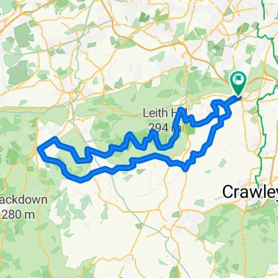
- 12.5 km
- Distance
- 97 m
- Ascent
- 99 m
- Descent
- ---
- Avg. speed
- ---
- Max. altitude

Route quality
Waytypes & surfaces along the route
Waytypes
Road
11.3 km
(91 %)
Quiet road
1.1 km
(9 %)
Surfaces
Paved
7.8 km
(63 %)
Asphalt
7.8 km
(63 %)
Undefined
4.6 km
(37 %)
Continue with Bikemap
Use, edit, or download this cycling route
You would like to ride Surrey League - Norwood Hill course or customize it for your own trip? Here is what you can do with this Bikemap route:
Free features
- Save this route as favorite or in collections
- Copy & plan your own version of this route
- Sync your route with Garmin or Wahoo
Premium features
Free trial for 3 days, or one-time payment. More about Bikemap Premium.
- Navigate this route on iOS & Android
- Export a GPX / KML file of this route
- Create your custom printout (try it for free)
- Download this route for offline navigation
Discover more Premium features.
Get Bikemap PremiumFrom our community
Other popular routes starting in Reigate
 Charlwood, Newdigate, Reigate
- Distance
- 55.5 km
- Ascent
- 261 m
- Descent
- 260 m
- Location
- Reigate, England, United Kingdom
 Leigh Loop CC
- Distance
- 37.6 km
- Ascent
- 219 m
- Descent
- 219 m
- Location
- Reigate, England, United Kingdom
 Reigate to Andover: RouteFinder 1
- Distance
- 101.1 km
- Ascent
- 592 m
- Descent
- 592 m
- Location
- Reigate, England, United Kingdom
 Reigate 28KM
- Distance
- 28.7 km
- Ascent
- 375 m
- Descent
- 375 m
- Location
- Reigate, England, United Kingdom
 1-hour
- Distance
- 23.3 km
- Ascent
- 132 m
- Descent
- 132 m
- Location
- Reigate, England, United Kingdom
 Restful route in Reigate
- Distance
- 16 km
- Ascent
- 207 m
- Descent
- 169 m
- Location
- Reigate, England, United Kingdom
 Wray Lane - Box - Wonham
- Distance
- 36.3 km
- Ascent
- 605 m
- Descent
- 606 m
- Location
- Reigate, England, United Kingdom
 Surrey League - Norwood Hill course
- Distance
- 12.5 km
- Ascent
- 97 m
- Descent
- 99 m
- Location
- Reigate, England, United Kingdom
Open it in the app