
ASCENSO AL MONT-SAINT-BAUDILLE
A cycling route starting in Montpeyroux, Occitanie, France.
Overview
About this route
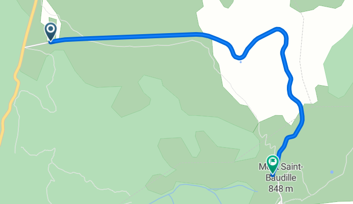
Mont Saint-Baudille, at 848 metres altitude, rises to the southwest of the Sainte-Baume massif, overlooking the Hérault valley and the plain of Saint-Guilhem-le-Désert. This short but intense climb is one of the most emblematic in the south of the Languedoc for its spectacular view and explosive character. The mountain takes its name from Saint Baudile, a martyr from Nîmes, and hosts an old telecommunications station on its summit that reinforces its distinctive profile visible from much of the valley.
- 16 min
- Duration
- 3.2 km
- Distance
- 169 m
- Ascent
- 39 m
- Descent
- 11.9 km/h
- Avg. speed
- 828 m
- Max. altitude

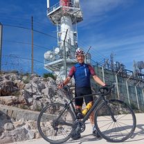
Route photos

Route quality
Waytypes & surfaces along the route
Waytypes
Quiet road
3.2 km
(99 %)
Path
0 km
(1 %)
Continue with Bikemap
Use, edit, or download this cycling route
You would like to ride ASCENSO AL MONT-SAINT-BAUDILLE or customize it for your own trip? Here is what you can do with this Bikemap route:
Free features
- Save this route as favorite or in collections
- Copy & plan your own version of this route
- Sync your route with Garmin or Wahoo
Premium features
Free trial for 3 days, or one-time payment. More about Bikemap Premium.
- Navigate this route on iOS & Android
- Export a GPX / KML file of this route
- Create your custom printout (try it for free)
- Download this route for offline navigation
Discover more Premium features.
Get Bikemap PremiumFrom our community
Other popular routes starting in Montpeyroux
 Montpeyroux - Circle through Gorges-de-l'Hérault and St-Jean-de-Buèges
- Distance
- 51.4 km
- Ascent
- 969 m
- Descent
- 979 m
- Location
- Montpeyroux, Occitanie, France
![[Terres Rouges] Descenso du Ruffles. ¡Espectacular!](https://media.bikemap.net/routes/11495871/staticmaps/in_3abb83c1-d439-45c9-aa9d-eb66077f5791_400x400_bikemap-2021-3D-static.png) [Terres Rouges] Descenso du Ruffles. ¡Espectacular!
[Terres Rouges] Descenso du Ruffles. ¡Espectacular!- Distance
- 22.2 km
- Ascent
- 1,136 m
- Descent
- 1,139 m
- Location
- Montpeyroux, Occitanie, France
 GIGNAC CIRQUE VISSEC
- Distance
- 93.7 km
- Ascent
- 1,472 m
- Descent
- 1,461 m
- Location
- Montpeyroux, Occitanie, France
 Mont Saint Baudille 2023
- Distance
- 60 km
- Ascent
- 1,790 m
- Descent
- 1,790 m
- Location
- Montpeyroux, Occitanie, France
 ASCENSO AL MONT-SAINT-BAUDILLE
- Distance
- 3.2 km
- Ascent
- 169 m
- Descent
- 39 m
- Location
- Montpeyroux, Occitanie, France
 Montpeyroux to Lodève
- Distance
- 24.3 km
- Ascent
- 172 m
- Descent
- 181 m
- Location
- Montpeyroux, Occitanie, France
 2014; route 7Abis naar Gignac (alternatief)
- Distance
- 4.4 km
- Ascent
- 25 m
- Descent
- 79 m
- Location
- Montpeyroux, Occitanie, France
 La Bueges
- Distance
- 54.3 km
- Ascent
- 783 m
- Descent
- 783 m
- Location
- Montpeyroux, Occitanie, France
Open it in the app