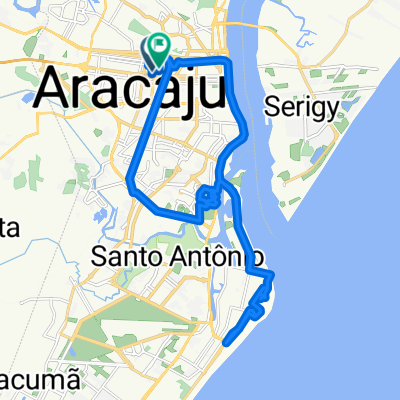
De Rua Miron de Oliveira Ribeiro a Rua Santa Cruz do Lagamar
- 16.4 km
- 129 m
- 145 m
- Aracaju, Sergipe, Brazil
A cycling route starting in Aracaju, Sergipe, Brazil.
Overview
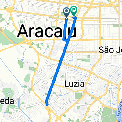
Explore the scenic 11.2 km cycling route, perfect for those looking to enjoy a gentle yet rewarding ride. The journey starts with a modest ascent of 33 meters, gradually building to a maximum elevation of 16 meters. Descend with ease, with a 32-meter descent providing a smooth transition back to lower altitudes. This route is ideal for both casual riders and those seeking a moderate challenge. The surface is well-maintained, ensuring a comfortable ride on paved paths. Whether you're a local or just passing through, this route offers a pleasant experience with its manageable terrain and scenic views.
AI generated
created this 2 months ago
Continue with Bikemap
You would like to ride Avenida Desembargador José Antônio de Andrade Gois, Aracaju a Rua Napoleão Dórea, Aracaju or customize it for your own trip? Here is what you can do with this Bikemap route:
Free trial for 3 days, or one-time payment. More about Bikemap Premium.
Discover more Premium features.
Get Bikemap PremiumFrom our community
Open it in the app