
Von Rapperswil-Jona bis Berlin
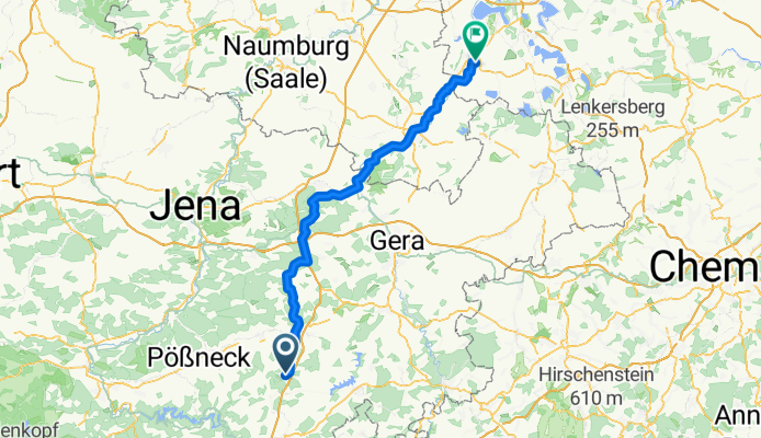
Moßbach - Groitzsch
A cycling route starting in Moßbach, Thuringia, Germany.
Overview
About this route
- 5 h 29 min
- Duration
- 86.4 km
- Distance
- 646 m
- Ascent
- 985 m
- Descent
- 15.7 km/h
- Avg. speed
- 507 m
- Max. altitude

Part of
Von Rapperswil-Jona bis Berlin
11 stages
Route quality
Waytypes & surfaces along the route
Waytypes
Track
28.5 km
(33 %)
Quiet road
25.9 km
(30 %)
Surfaces
Paved
61.3 km
(71 %)
Unpaved
9.5 km
(11 %)
Asphalt
55.3 km
(64 %)
Gravel
8.6 km
(10 %)
Continue with Bikemap
Use, edit, or download this cycling route
You would like to ride Moßbach - Groitzsch or customize it for your own trip? Here is what you can do with this Bikemap route:
Free features
- Save this route as favorite or in collections
- Copy & plan your own version of this route
- Split it into stages to create a multi-day tour
- Sync your route with Garmin or Wahoo
Premium features
Free trial for 3 days, or one-time payment. More about Bikemap Premium.
- Navigate this route on iOS & Android
- Export a GPX / KML file of this route
- Create your custom printout (try it for free)
- Download this route for offline navigation
Discover more Premium features.
Get Bikemap PremiumFrom our community
Other popular routes starting in Moßbach
 Ortsstraße, Moßbach nach Ortsstraße 64C, Moßbach
- Distance
- 14.9 km
- Ascent
- 108 m
- Descent
- 120 m
- Location
- Moßbach, Thuringia, Germany
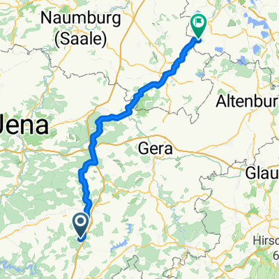 Moßbach - Elstertrebnitz
- Distance
- 81.1 km
- Ascent
- 635 m
- Descent
- 973 m
- Location
- Moßbach, Thuringia, Germany
 Ortsstraße 64C, Moßbach nach Ortsstraße 64C, Moßbach
- Distance
- 18.1 km
- Ascent
- 233 m
- Descent
- 232 m
- Location
- Moßbach, Thuringia, Germany
 L2350, Linda bei Neustadt an der Orla nach Centbaumweg 10, Neustadt an der Orla
- Distance
- 18 km
- Ascent
- 116 m
- Descent
- 232 m
- Location
- Moßbach, Thuringia, Germany
 Saaletour inkl. Talsperre Hohenwarte
- Distance
- 86.9 km
- Ascent
- 1,372 m
- Descent
- 1,365 m
- Location
- Moßbach, Thuringia, Germany
 Recovered Route
- Distance
- 21.8 km
- Ascent
- 500 m
- Descent
- 501 m
- Location
- Moßbach, Thuringia, Germany
 Rund um den Hohenwartestausee
- Distance
- 83.5 km
- Ascent
- 1,049 m
- Descent
- 1,050 m
- Location
- Moßbach, Thuringia, Germany
 Ortsstraße 79, Moßbach nach Ortsstraße 64C, Moßbach
- Distance
- 9.4 km
- Ascent
- 103 m
- Descent
- 106 m
- Location
- Moßbach, Thuringia, Germany
Open it in the app