
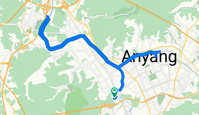
안양8동 산162-5 ~ 안양동 349-44
A cycling route starting in Anyang-si, Gyeonggi-do, South Korea.
Overview
About this route
- 1 h 56 min
- Duration
- 24.3 km
- Distance
- 112 m
- Ascent
- 134 m
- Descent
- 12.6 km/h
- Avg. speed
- 65 m
- Max. altitude
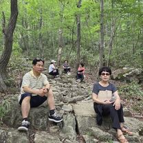
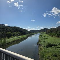
Route photos


Continue with Bikemap
Use, edit, or download this cycling route
You would like to ride 안양8동 산162-5 ~ 안양동 349-44 or customize it for your own trip? Here is what you can do with this Bikemap route:
Free features
- Save this route as favorite or in collections
- Copy & plan your own version of this route
- Sync your route with Garmin or Wahoo
Premium features
Free trial for 3 days, or one-time payment. More about Bikemap Premium.
- Navigate this route on iOS & Android
- Export a GPX / KML file of this route
- Create your custom printout (try it for free)
- Download this route for offline navigation
Discover more Premium features.
Get Bikemap PremiumFrom our community
Other popular routes starting in Anyang-si
![비산동Ph0]으로 라우팅](https://www.bikemap.net/media/temp/routes_gallery/fb1e8679-cd1e-457c-80db-81fc167fcbdf.jpg) 비산동Ph0]으로 라우팅
비산동Ph0]으로 라우팅- Distance
- 7.7 km
- Ascent
- 251 m
- Descent
- 265 m
- Location
- Anyang-si, Gyeonggi-do, South Korea
 안정적인 라이딩
- Distance
- 47 km
- Ascent
- 215 m
- Descent
- 221 m
- Location
- Anyang-si, Gyeonggi-do, South Korea
![송죽동 390-14Ph0]으로 라우팅](https://media.bikemap.net/routes/17523117/gallery/thumbs/a42265c1-2129-4976-b3b6-55210c51286a.jpg.208x208_q80_crop.jpg) 송죽동 390-14Ph0]으로 라우팅
송죽동 390-14Ph0]으로 라우팅- Distance
- 69.3 km
- Ascent
- 218 m
- Descent
- 228 m
- Location
- Anyang-si, Gyeonggi-do, South Korea
 test
test- Distance
- 0.8 km
- Ascent
- 12 m
- Descent
- 74 m
- Location
- Anyang-si, Gyeonggi-do, South Korea
 의왕시 - 당산역
- Distance
- 33.9 km
- Ascent
- 119 m
- Descent
- 157 m
- Location
- Anyang-si, Gyeonggi-do, South Korea
 2023.09.02
- Distance
- 48.3 km
- Ascent
- 130 m
- Descent
- 163 m
- Location
- Anyang-si, Gyeonggi-do, South Korea
 안양8동 산162-5 ~ 안양동 349-44
- Distance
- 24.3 km
- Ascent
- 112 m
- Descent
- 134 m
- Location
- Anyang-si, Gyeonggi-do, South Korea
 안양 - 소레포구
- Distance
- 33.2 km
- Ascent
- 325 m
- Descent
- 344 m
- Location
- Anyang-si, Gyeonggi-do, South Korea
Open it in the app