
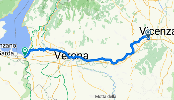
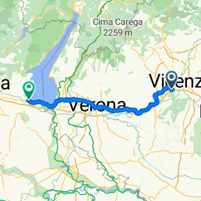
Da Altavilla Vicentina a Peschiera del Garda
A cycling route starting in Altavilla Vicentina, Veneto, Italy.
Overview
About this route
- 5 h 1 min
- Duration
- 88.7 km
- Distance
- 513 m
- Ascent
- 475 m
- Descent
- 17.7 km/h
- Avg. speed
- 205 m
- Max. altitude

Route quality
Waytypes & surfaces along the route
Waytypes
Road
30.2 km
(34 %)
Quiet road
25.7 km
(29 %)
Surfaces
Paved
72.8 km
(82 %)
Unpaved
2.7 km
(3 %)
Asphalt
69.2 km
(78 %)
Paved (undefined)
2.7 km
(3 %)
Continue with Bikemap
Use, edit, or download this cycling route
You would like to ride Da Altavilla Vicentina a Peschiera del Garda or customize it for your own trip? Here is what you can do with this Bikemap route:
Free features
- Save this route as favorite or in collections
- Copy & plan your own version of this route
- Split it into stages to create a multi-day tour
- Sync your route with Garmin or Wahoo
Premium features
Free trial for 3 days, or one-time payment. More about Bikemap Premium.
- Navigate this route on iOS & Android
- Export a GPX / KML file of this route
- Create your custom printout (try it for free)
- Download this route for offline navigation
Discover more Premium features.
Get Bikemap PremiumFrom our community
Other popular routes starting in Altavilla Vicentina
 Via Vicenza, Altavilla Vicentina a Desenzano del Garda
- Distance
- 103.3 km
- Ascent
- 549 m
- Descent
- 518 m
- Location
- Altavilla Vicentina, Veneto, Italy
 Perarolo 19km 390md+
- Distance
- 18.8 km
- Ascent
- 468 m
- Descent
- 470 m
- Location
- Altavilla Vicentina, Veneto, Italy
 colli berici
- Distance
- 79 km
- Ascent
- 1,373 m
- Descent
- 1,369 m
- Location
- Altavilla Vicentina, Veneto, Italy
 AG-Nogarole-SelvaTrissino-Castelgomberto
- Distance
- 70.1 km
- Ascent
- 648 m
- Descent
- 647 m
- Location
- Altavilla Vicentina, Veneto, Italy
 Colline Altavilla Vicentina
- Distance
- 77.9 km
- Ascent
- 929 m
- Descent
- 941 m
- Location
- Altavilla Vicentina, Veneto, Italy
 01_maraton
- Distance
- 25.9 km
- Ascent
- 703 m
- Descent
- 481 m
- Location
- Altavilla Vicentina, Veneto, Italy
 Trail Colli Berici 40 Km
- Distance
- 41.9 km
- Ascent
- 1,071 m
- Descent
- 1,073 m
- Location
- Altavilla Vicentina, Veneto, Italy
 xxberici 18.06.15
- Distance
- 41 km
- Ascent
- 535 m
- Descent
- 540 m
- Location
- Altavilla Vicentina, Veneto, Italy
Open it in the app