
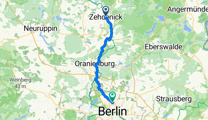
kcinedheZ
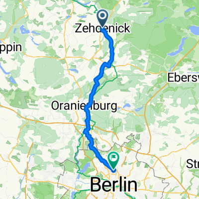
A cycling route starting in Zehdenick, Brandenburg, Germany.
Overview
About this route
- 3 h 37 min
- Duration
- 62.6 km
- Distance
- 168 m
- Ascent
- 168 m
- Descent
- 17.3 km/h
- Avg. speed
- 63 m
- Max. altitude

Route quality
Waytypes & surfaces along the route
Waytypes
Quiet road
21.3 km
(34 %)
Path
21.3 km
(34 %)
Surfaces
Paved
58.2 km
(93 %)
Unpaved
1.9 km
(3 %)
Asphalt
57.6 km
(92 %)
Gravel
1.3 km
(2 %)
Continue with Bikemap
Use, edit, or download this cycling route
You would like to ride kcinedheZ or customize it for your own trip? Here is what you can do with this Bikemap route:
Free features
- Save this route as favorite or in collections
- Copy & plan your own version of this route
- Sync your route with Garmin or Wahoo
Premium features
Free trial for 3 days, or one-time payment. More about Bikemap Premium.
- Navigate this route on iOS & Android
- Export a GPX / KML file of this route
- Create your custom printout (try it for free)
- Download this route for offline navigation
Discover more Premium features.
Get Bikemap PremiumFrom our community
Other popular routes starting in Zehdenick
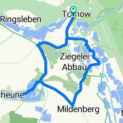 Zehdenick Tornow rund
- Distance
- 19.9 km
- Ascent
- 61 m
- Descent
- 61 m
- Location
- Zehdenick, Brandenburg, Germany
 01 Von Zehdenick bis Canon
- Distance
- 62.4 km
- Ascent
- 462 m
- Descent
- 450 m
- Location
- Zehdenick, Brandenburg, Germany
 tour 2025 2. Etappe Rheinsberg
- Distance
- 69.8 km
- Ascent
- 410 m
- Descent
- 397 m
- Location
- Zehdenick, Brandenburg, Germany
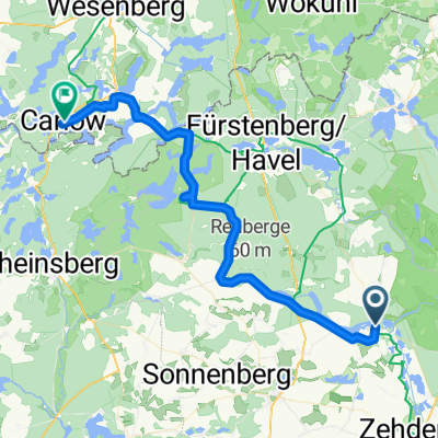
 Berlin - Copenhagen - Day 1, Adapted 2nd Leg (Zehdenick to Füstenberg/Havel)
- Distance
- 36 km
- Ascent
- 97 m
- Descent
- 88 m
- Location
- Zehdenick, Brandenburg, Germany
 kcinedheZ
- Distance
- 62.6 km
- Ascent
- 168 m
- Descent
- 168 m
- Location
- Zehdenick, Brandenburg, Germany
 2Tag-2.Etappe auf B-Ko Weg
- Distance
- 64.7 km
- Ascent
- 230 m
- Descent
- 214 m
- Location
- Zehdenick, Brandenburg, Germany
 2222222.
- Distance
- 92.5 km
- Ascent
- 256 m
- Descent
- 283 m
- Location
- Zehdenick, Brandenburg, Germany
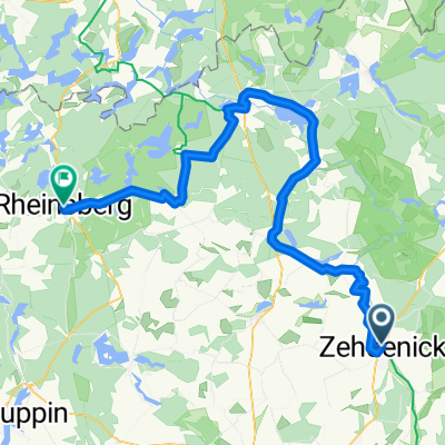
 Zehdenick Furstenberg
- Distance
- 44.8 km
- Ascent
- 166 m
- Descent
- 198 m
- Location
- Zehdenick, Brandenburg, Germany
Open it in the app